One lane, many names

My first blog post for the tenth anniversary of Society for One Place Studies  ⇗ in 2023 looked at one of Waters Upton’s lanes. A minor road, it runs from the Northeast end of Waters Upton village to a tiny settlement in the south-eastern corner of the parish, The Terrill. The name of this lane – and of some of the fields lying close by – has been written in a variety of ways over the years, and I had a feeling there might have been as many as ten different spellings. I did indeed find ten versions and so I was able to write a post to which the #OnePlaceStudies10 hashtag applied. This is a revised and expanded version of that post.
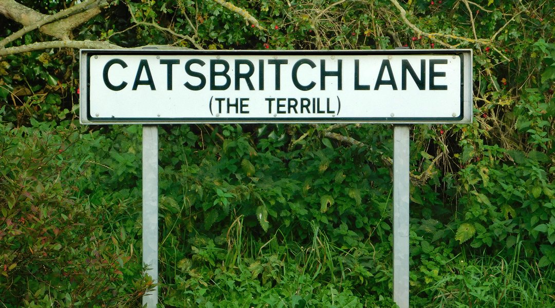
Photo of a street name sign, standing (on two metal struts) on a road verge and by a hedge. The sign says Catsbritch Lane, with The Terrill in smaller letters below, in brackets.
Catsbritch Lane sign at the Western end of the road.

Here are all the names for the lane in question, and features sharing its name, that I have found so far:

  • Caspich Lane – The earliest written references I have found for this lane were in the records of baptisms which took place at Waters Upton on 10 October 1782 and 20 April 1788. The first was of Ann, daughter of John and Ann Ouls, the second was of Ann’s brother Thomas (with the family’s surname written as Houls). I will return to these register entries shortly.
  • Casprick Lane – This was the place of residence given in the parish register for Edward and Ann Davies, when their daughter Mary was baptised on 17 Dec 1809.
  • Castpit Lane – We’re looking at the parish register again, but have jumped forward to the 1850s. Samuel, son of William and Ann Matthews of “Castpit-lane” was baptised on 14 Jul 1850, while Ellen, daughter of Morris and Elizabeth Evans of Castpit lane was baptised on 5 October 1856.
  • Caspit Lane – Within three months of the above ceremony, on 4 January 1857, there was another baptism in which the lane, with another variation of its spelling, was given as the family’s abode. The child was Mary Ann, daughter of John and Elizabeth Skitt.
  • Catsbritch – Part of a ‘double name’ (Far Britch and Catsbritch) for a parcel of land near the lane, recorded on the Tithe Apportionment Schedule of 1837. This spelling, applied to the lane, later appeared on one of the Ordnance Survey’s 25 inch to the mile maps  ⇗ covering part of Waters Upton parish, published in 1902. It then became more or less fixed as the standard name and this is the spelling in use today. (The map below is an extract from later Ordnance Survey mapping, at a scale of 1:25,000, published about 1949.)
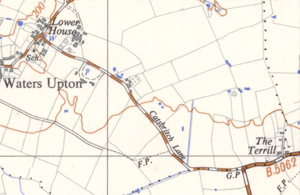
Extract from an Ordnance Survey map published about 1949. It shows part of the village of Waters Upton in the top left corner, and a minor road heading South-eastward from it, named Catsbritch Lane. Before the lane reached the bottom of the map extract it turns to head more directly Eastward to a junction with the B5062 road, and a small settlement named The Terrill.
  • Casbritch – The Tithe Apportionment Schedule of 1837 also recorded three adjoining fields named Long Casbritch, Far Casbritch, and Near Casbritch (the last-named lying immediately to the West of the lane).
  • Castpits Lane – the census of 1871 was the first one on which the name of this lane appeared. The enumerator, describing his enumeration district, referred to it as Castpits Lane – but he also referred to…
  • Catsbrich Toll House and Bars / Cat’s Brich Bars – Situated on Castpits Lane, but the name given to the toll house and bars was written with two variants of a different spelling. The first version appeared in the enumeration district description mentioned above, the second version on the page summarising the household census return made on schedule 72.
  • Catspit Lane – This version of the lane’s name was first used in 1881, in newspaper notices of the sale of the furniture and other effects of the late Thomas Lloyd. Two more census enumeration district descriptions – in 1891 and 1901 – also featured this particular spelling.
  • Gaspit Lane – The address in Waters Upton given for a Mrs Jones, who advertised in 1893 for a “healthy Child, few months old” to whom she would provide a good home in a healthy place on moderate terms.
  • Cats Birch Lane – When field books were compiled as part of the survey of Waters Upton under the 1910 Land Valuation Act, another variant spelling came into being. This one appeared in the entries for 5, 6 and 7 Waters Upton (field book ref 613).
  • Catsbrick Lane – The Ordnance Survey might have made Catsbritch Lane the definitive version of this road’s appellation in 1902, but that didn’t stop 1921 census enumerator Edgar Percy Davies from going his own way. He used this spelling in his brief description of the Waters Upton enumeration district.
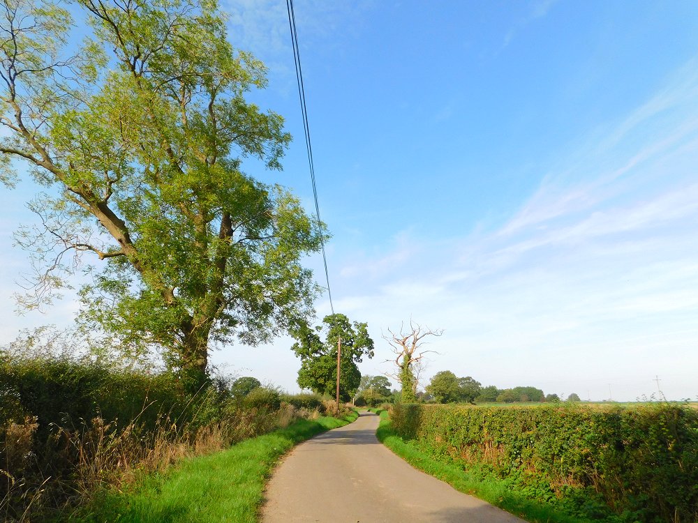
A photo of a country lane running between two hedgerows which contain occasional trees, the closest of which, on the left, is an Ash tree. It is a bright, sunny day with a blue sky in early Autumn, so the trees and the the well-trimmed shrubs in the hedgerows have green leaves.
A photo taken on Catsbritch Lane in 2023.

To summarise, over the course of 140 years of written records, the first part of this lane’s name evolved from ‘Cas’ to ‘Cats,’ with ‘Cast’ and ‘Gas’ also appearing. The second part meanwhile changed from ‘pich,’ to ‘pit’ and ‘pits’ (with the variant ‘spit’), and ultimately to ‘brich’ and ‘britch’ (with variants ‘birch’ and ‘brick’). Many of these spellings can probably be explained by people writing down what they heard (or thought they heard) when the name was given to them. And we cannot rule out the possibility of typos occurring, when the name appeared in print.

Origin story

What might the origins of this lane’s changeable name be – could its etymology be enlightening? I decided to approach this line of enquiry backwards, as it were, by starting with the second part of the name.

One obvious possibility is that the name referenced a pit or pits of some kind. The 1837 Tithe Apportionment Schedule for Waters Upton included two fields described (in whole or in part) as Kynnersley Pit. There was also a single parcel of land called Great Britch & Marlpit Croft. This suggests the potential for there to have been a marl pit, or perhaps a claypit (a source of raw material for bricks), which has since vanished or which survives as a pond, after which the lane from Waters Upton to The Terrill was named. There are certainly several ponds in the fields on the North side of the lane.

The ‘Great Britch’ element of that last-mentioned field name points in another direction however. Including those already mentioned, there were in total 16 parcels of land in Waters Upton parish which had ‘Britch’ as part, or as the whole, of their names: Britch x 4, Long Britch x 2, Upper Britch x 2, and one each of Lower Britch, Britch Head, and Far Britch. All of them lay in the south-eastern part of the parish near – or right next to – the road now known as Catsbritch Lane, and all were arable fields.
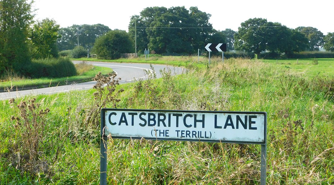
Photo of a street name sign, standing (on two metal struts) in an area of long grass close to a curving section of road with hedgerows and fields on either side. The sign says Catsbritch Lane, with The Terrill in smaller letters below, in brackets.
Catsbritch Lane sign at the Eastern end of the road.

Internet searches led me to various useful sources including a thesis by David Horovitz, A survey and analysis of the place-names of Staffordshire ⇗. From these I learned that the word britch (and variants of it including brache, breche, bruche, brych and even bridge) occur in many other place names in England. It is derived from an Old English word referring to land recently cleared or broken up for cultivation, and there are examples of it being used in conjunction with personal names.

So Catsbritch Lane may have a name with origins going back several hundred years – to a time when the uncultivated land it led to, perhaps belonging to someone with the Old English personal name Catt, was cleared and broken up, ready to be planted with crops.

The end of the road

Where does Catsbritch Lane end, and has that changed over time? Following road improvement works, the Easternmost end of Catsbritch Lane is clearly marked at its junction with the road between Crudgington and Cherrington, part of the B5062. (That junction is a little further to the East of its original location.) Before those road works, and particularly before the B road designation of the route which (in part) links the aforementioned villages, maybe things were less clear cut.
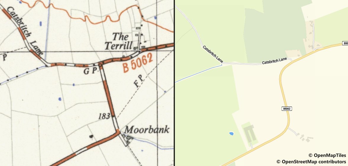
Two map extracts combined in a single image; both show the same area, more or less centred on the the junction of the two roads running through the map, to the West of a small settlement named The Terrill. On the left, an Ordnance Survey map from around 1949 shows the B5062 road heading from near the bottom left to a point below the top right, in a series of three fairly straight stretches with two sharp corners (the uppermost of which is the aforementioned junction). On the right, modern Open Street Map mapping shows that the sharp corners on the B5062 have been replaced with curving bends.
Two map extracts combined in a single image, showing the junction of Catsbritch Lane and the B5062 before and after road improvement work. On the left is Ordnance Survey 1:25,000 mapping from around 1949; on the left is present day OpenMapTiles / OpenStreetMap mapping.

I was prompted to think about this by the first record of Catsbritch Lane in the list above, the parish register entry from 1782 for the baptism of Ann Ouls (or Houls). That entry referred to “Caspich Lane, Ercal Parish” – in other words, the family’s abode was situated on (or very near) to the lane but in the neighbouring parish of Ercall Magna. The baptism of Ann’s brother Thomas gave only the name of the lane, so was the earlier reference to Ercall an error? Or was there a dwelling on the Ercall side of the lane, presumably in the vicinity of The Terrill where the Waters Upton – Ercall Magna parish boundary ran along the centre of the highway?

There is another Houls family baptism in the Waters Upton register which is relevant. On 16 Jun 1790 a private baptism was performed for “Joseph, the Son of John & Ann Houls, Crudgington Liby.” (The last word was, I think, an abbreviation of ‘Liberty.’) This placed the Houls family’s abode in the township of Crudgington, in Ercall Magna parish. Where was that abode though? I see three possibilities:

  • A dwelling on the South side of Catsbritch Lane, in Ercall Magna parish, which was pulled down before it could be mapped in the 1800s (just as dwellings further West on the lane and within Waters Upton parish, which survived until the tithe map was drawn up in 1837, were demolished at some point during the years that followed)
  • A dwelling known (at least in and after the 1800s) as The Spring, to the East of The Terrill and just inside the Ercall Magna parish boundary
  • Moorbank, south of The Terrill (which would mean that the name Catsbritch Lane extended down the road leading to that place
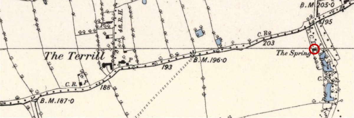
Extract from an old, large-scale Ordnance Survey map showing a stretch of road running from near the bottom left corner across to the top right corner. Towards the left, North of the road, is a small settlement named The Terrill. Near the right edge of the map extract, and South of the road, is a dwelling named The Spring.
A map made of extracts from two 6 inch to the mile Ordnance Survey maps published in 1886/87, showing The Terrill and, circled in red, The Spring.

The first two possibilities would be difficult to either prove or disprove, but the third can probably be ruled out. From 15 Feb 1774 to 20 May 1788 baptisms were recorded in the Waters Upton register for children of William and Jane Bennett of Moor Bank. If the Houls family also lived there, their place of residence would surely have been recorded in the same way.

So, although there is no definitive proof, I think it is entirely possible that people in the past applied the name Catsbritch Lane (or variations of it) not just to the lane leading up to the junction with the Crudgington – Cherrington road but beyond that point, at the very least as far as The Terrill, and perhaps all the way to Shray Hill.


Picture credits. All photos by the author. All maps reproduced with the permission of the National Library of Scotland ⇗ under a Creative Commons licence ⇗, except for OpenStreetMap / OpenMapTiles mapping (indicated above), used under a Creative Commons licence ⇗.
Waters Upton Woolleys in World War One (Part 1)

My previous post, The Top Ten surnames of Waters Upton, revealed that Woolley was the ‘top’ surname in the parish across the censuses taken from 1841 to 1921. This was illustrated with a photo showing part of the Roll of Honour which is mounted in the porch of St Michel’s church in Waters Upton. Of the 40 men from the parish whose service during the First World War was commemorated on that memorial, a full quarter bore the surname Woolley. So, for Remembrance Sunday, I’m going to start telling the stories of the Waters Upton Woolleys who went to war.

Rather than diving straight in to the individual stories of the Woolley servicemen, I’m going to start by looking at them as a group – exploring what the men had in common, and some of the things that made each of their experiences unique. Let’s begin with one big thing they all shared, aside from (but connected with) their surname.

Brothers (and cousins) in arms

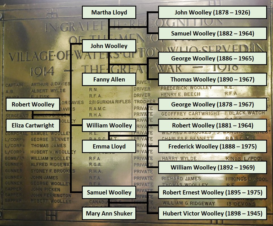
Another of the take-aways from my ‘Top Ten’ surnames post was that the Woolleys of Waters Upton, at least through what I call the ‘census era’ (1841 to 1921), were one big family. With the exception of the women who ‘married in,’ every Woolley enumerated by those censuses was descended from a couple who married at Waters Upton in 1783. The ten Woolley men named on the parish Roll of Honour were all 3x great grandsons of that couple.

A chart showing the names of the ten Woolley men discussed in this article, with their dates of birth, and lines connected each to their parents and, via their parents, to their shared grandparents. In the background is a photo of the brass Roll of Honour in Waters Upton church, on which all ten Woolley men are named along with 30 other men connected with the parish.
Relationships between the Woolley men whose names are on the Waters Upton Roll of Honour. Image by the author.

So, they were all related – but more than that, they were closely related. All of them were grandsons of Robert Woolley (alias Birch, 1818 – 1891) and Eliza (née Cartwright, 1818 – 1897). Three of that couple’s sons begat the Woolleys whose names would be inscribed on the Waters Upton Roll of Honour:

  • John (1845 – 1929), who married Martha Lloyd (1842 – 1885) and, after her death, Fanny Allen (1853 – 1936)
  • William (c1851 – 1939), who wed Emma Lloyd (1852 – 1931)
  • Samuel (1863 – 1936), who tied the knot with Mary Ann Shuker (1871 – 1947)

Each one of the three groups of ‘brothers in arms’ were therefore first cousins of the other two groups.

Before the Great War

Let’s now look at the lives of our cohort of closely-related Woolleys before they joined up. Where were they born? Where were they living and what jobs were they engaged in when they decided to enlist? The latter questions are usually easy to answer for those whose service records survived the Blitz 🡕 of World War 2 and have been digitised. Including ‘burnt records’ (which are intact but not necessarily complete due to fire damage), and one Canadian personnel file (which was not at risk of enemy bombing in WW2), five of the 10 Woolleys have such service records. For some of the others, I have found alternative sources of information.

In the following table, names follow the order in the family tree chart above, counties (or, in two cases, countries) are given only for places outside Shropshire.

NameBirth
year
Birth
place
Pre-war residencePre-war occupation
John1878Waters UptonNewtown, MontgomeryshireInnkeeper
Samuel *1882CherringtonBuenos Aires, ArgentinaEngine Driver
George1886Gnosall, StaffordshireNK (Moreton Say in 1911)Gardener
Thomas *1890Gnosall, StaffordshireStaffordshireBlacksmith
George *1878Waters UptonYorkshireGardener
Robert *1881Waters UptonOttawa, CanadaIronworker
Frederick1888Waters UptonNK (Sedgwick, Westmorland in 1911)NK (Servant in 1911)
William1892Waters UptonNK (Belbroughton, Worcestershire in 1911)NK (Groom in 1911)
Robert Ernest *1895Waters UptonBirmingham, WarwickshirePolice Officer
Hubert Victor1898Waters UptonNK (Waters Upton in 1911)NK
* Service records survived and are online

Seven out of our ten subjects were natives of Waters Upton, but three, all sons of John Woolley, were born elsewhere. I have found no records to show that Samuel or Thomas ever set foot in the parish, but their father John and mother / stepmother Fanny lived at Waters Upton from about 1915, so they may well have visited. (This seems a tenuous connection for them to have appeared on the parish Roll of Honour, but there are other examples.)

While most of the Woolley boys were Waters Upton born, almost all of them (and all of those born elsewhere) left their native parish to find work when they grew up. As a result, they were living in a variety of places during the first years of the Great War. Furthest from home were Samuel and Robert, on the other side of the Atlantic. George left his employment with the Great Western Railway in 1911 “to take situation on Buenos Ayres & Pacific Rwy” while Robert emigrated to Canada with his wife and infant son in 1912. Those who did not leave these shores were distributed over as many as seven counties in England and Wales.

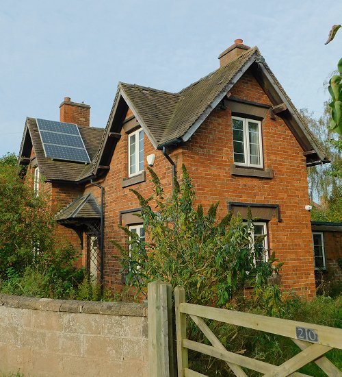
Photo of numer 20, Waters Upton, known as Sutherland Cottage. A three-nay, two-storey cottage made from red bricks, with a tiled roof from which two chimney stacks rise. Set in garden behind a low stone wall and a wooden gate.
20 Waters Upton (Sutherland Cottage), home of Robert Ernest and Hubert Victor Woolley. Photo by the author.

Even the youngest of the ten Wooley men, Hubert Victor Woolley, might have left his home parish before Britain entered the war. He would have been 16 at that time, and almost certainly working – but where, and as what? A lack of service records (or alternative sources) for two of Hubert’s cousins means that I cannot be certain about the work they were engaged in either. For both Frederick and William Woolley, I only have the 1911 census to tell me about their circumstances a few years before the war.

The other Woolleys held a variety of occupations, including blacksmith, engine driver, innkeeper and ironworker, with only two doing the same job: both Georges were gardeners. Almost all of these men gave up their employment voluntarily to join the war effort – but Robert Ernest Woolley’s short-lived stint as a police officer ended when he was dismissed. He enlisted eight days later.

Soldiers of the King

Finally, let’s look at a few aspects of the ten Woolley men’s wartime service. In the following table, the first two columns are the same as in the one above, any post-war military service is ignored, and GSW is an abbreviation of Gunshot Wound.

NameBirth
year
WW1 – Regiment(s) joinedWW1 – Overseas serviceWW1 – Injuries etc sustained
John1878Welsh GuardsFranceTrench Fever
Samuel *1882Royal EngineersFranceGassed
George1886Royal Field ArtilleryFrance?GSW to elbow
Thomas *1890Royal Army Service CorpsEast Africa, FranceMalaria
George *1878Yorkshire Regiment, Labour CorpsFranceGassed, GSW
Robert *1881Canadian EngineersFranceFinger Crushed (accident)
Frederick1888Royal EngineersNKNK
William1892Royal Field ArtilleryNKNK
Robert Ernest *1895Middlesex RegimentSalonika, BalkansDysentery
Hubert Victor1898KSLI, Welsh RegimentFranceNK
* Service records survived and are online

The range of places where the Woolleys ended up living and working played a part in the variety of regiments they joined when they answered the call to serve their King and country. Only one, Hubert Victor Woolley, enlisted the regiment of his county of birth. Having done so, he was transferred from the King’s Shropshire Light Infantry to the Welsh Regiment soon after he arrived in France.

Two more who joined regiments local to where they were living were John, of Newtown (Welsh Guards), and George (son of William), of Yorkshire (Yorkshire Regiment). The latter went on to serve later in the war with the Labour Corps. George’s brother Robert enlisted with his adopted country’s army, and became a Sapper with the Canadian Engineers. Back in Britain, cousins Samuel and Frederick both joined the Royal Engineers, while the Royal Field Artillery recruited cousins George (son of John) and William Woolley.

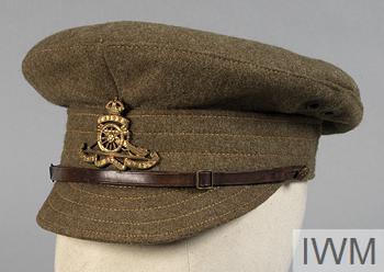
Royal Field Artillery 1917 Pattern Field Cap, Other Ranks. Copyright: © IWM, (UNI 12681 🡕); used under the IWM Non-Commercial Licence 🡕.

Two more who joined regiments local to where they were living were John, of Newtown (Welsh Guards), and George (son of William), of Yorkshire (Yorkshire Regiment). The latter went on to serve later in the war with the Labour Corps. George’s brother Robert enlisted with his adopted country’s army, and became a Sapper with the Canadian Engineers. Back in Britain, cousins Samuel and Frederick both joined the Royal Engineers, while the Royal Field Artillery recruited cousins George (son of John) and William Woolley.

Robert Ernest Woolley had been living in Birmingham, so why did he go to London and enlist there with the Middlesex Regiment? Possibly because the reason why his employment with the Birmingham City Police ended was published in the local press. Robert may have believed that by moving away he would stand a better chance of being taken on as a soldier. This decision would lead to service in the Balkans during the Salonika Campaign, attacks of dysentery, and the award of a medal from the King of Italy.

Service records are the best source of information about time spent overseas, and about any injuries or illnesses leading to hospital admissions. In their absence, other sources can often fill in some of the gaps; those alternatives have helped me with three of the Woolleys. As a result, I know that at least six – possibly seven – of the ten Woolley brothers (and cousins) in arms served in France. Of those six or seven, Thomas also spent time with the Army Service Corps in East Africa.

At least seven of the Woolleys ended up with injuries or illnesses as a result of their military service. Robert Ernest Woolley’s dysentery I have already mentioned. Thomas was infected with Malaria.  Samuel was gassed, George (son of John) received a gunshot wound, while the other George (son of William) was suffered from both of those misfortunes. John with Trench Fever and Robert, whose finger was crushed in an accident, round off the list of casualties.

Each of the ten Woolley men honoured on the Waters Upton Roll of Honour have very different tales to tell about their lives before, during and after the Great War. I hope to build on the overview provided here by telling their stories in more detail in future articles.

The ‘Top Ten’ surnames of Waters Upton

Back in 2023, in connection with the tenth anniversary of the founding of the Society for One-Place Studies, I proposed the blogging prompt Ten (hashtag #OnePlaceStudies10). One of the ideas I put forward for blogging on that theme was ‘the top ten surnames of your OPS’ and, having suggested it, I decided to have a go myself. So began a deep dive into the surnames of Waters Upton’s residents, and in due course a blog post. Originally shared on the Society’s website, I am now adding a longer version of it to the Waters Upton website.

The first question that arose when I embarked on this quest was: “How exactly do I work out what the ‘top ten’ surnames of Waters Upton were?” I decided to use data from the nine censuses from 1841 to 1921 inclusive. Counting variants of any given last name (e.g. Brown and Browne, or Picken and Pickin) as a single family name, I established that 236 different surnames were recorded at Waters Upton on the nine censuses. Of those, 192 occurred less than ten times in total – including 92 which appeared only once.

The number of people enumerated in Waters Upton parish on each census from 1841 to 1921 was, on average, just 201. As a result of this, looking at surnames on any one census, while interesting, did not lead to any meaningful conclusions. In many years a surname could get into the ‘Top Ten’ by virtue of it being borne by just six people!

The method I finally arrived at for calculating the Top Ten Surnames of Waters Upton was based on counting the number of individual surname holders enumerated in the parish across all of the nine census years, counting each individual only once regardless of the number of censuses they appeared in.

So, I would establish the Top Ten surnames of Waters Upton over the period from 1841 to 1921. After a fashion, that is. My chosen method would fail to include any of the people who lived in the parish between censuses. However, given that it would be impossible to identify all of those ‘in-betweeners,’ using the decennial snapshots of the parochial population provided by the censuses was the only way to go.

The Top Ten

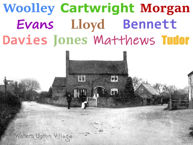
An old black and white photo (from a postcard) showing a three-bay, two-storey house with a tiled roof and end stacks, stood at the junction of two roads. Above the house, the names Woolley, Cartwright, Morgan, Evans, Lloyd, Bennett, Davies, Jones, Matthews and Tudor have been added in various font styles and colours.

The results of my calculations (with the number of surname holders in brackets) were as follows:

1.

2.

3.

4 =

6.

7 =

9 =

Wooley (52)

Cartwright (32)

Morgan (31)

Evans and Lloyd (29 each)

Bennett (27)

Davies and Jones (26 each)

Matthews and Tudor (25 each)

Looking at this list, one of the first things that struck me was that six out of the ten surnames – Morgan, Evans, Lloyd, Davies, Jones and Tudor – had Welsh origins. This was no great surprise given that Waters Upton lies in a county on England’s border with Wales. These family names do of course occur at high frequencies elsewhere too. “Commonly occurring surnames dominate Top Ten” would hardly be a shocking finding – but to what extent was that the case?

In checking my data to make sure that I didn’t double-count individuals who were recorded on more than one census, I found many who were enumerated on multiple occasions. The record was held by a William Matthews, enumerated at Waters Upton eight times from 1851 to 1921 inclusive; he appears in the story A fatal tricycle accident at Waters Upton.

It wasn’t just individuals who were ‘long-stayers’ in the parish – there were families which remained in (or returned to) Waters Upton over two or more generations. The long-term presence of such families would certainly have an impact on the Top Ten surnames.

So, high frequency surnames occurring, erm, frequently, and ‘faithful families’ perpetuating their family names – to what extent did each of these two factors influence the final results? In the discussion that follows, the term ‘descendants’ includes women who ‘married in.’

Cartwright and Jones

At one end of the scale there were the Cartwrights and the Joneses. The 26 Joneses were comprised of a family of eight, two families of four, a married couple, a mother and her child, and six other individuals. None of the families were represented by more than two generations (i.e. parents and children). The surname Jones appears to have made it into my Top Ten almost entirely because it was a very high frequency surname.

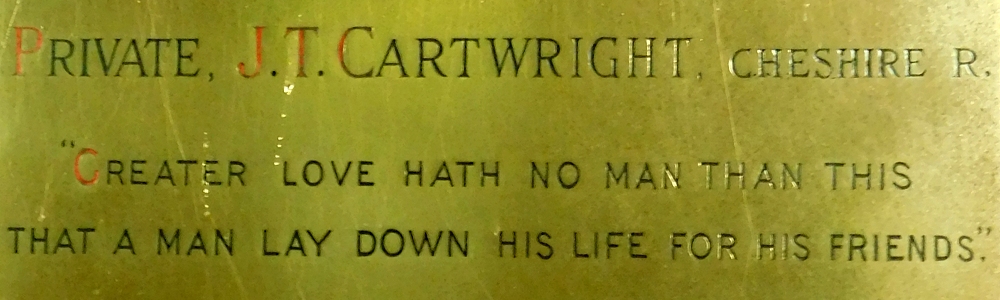
Photo of part of the war memorial brass inside the church at Waters Upton, showing the name Private J T Cartwright (Cheshire Regiment) followed by the words: Greater love hath no man than this, that a man lay down his life for his friends.
Private John Thomas Cartwright, whose sacrifice during the First World War is remembered on the war memorial brass inside the church at Waters Upton. Photo by the author.

As for the Cartwrights, Sarah the widow of George Cartwright and her descendants account for 10 of 32 people bearing that surname on census returns; the rest were from four other families. Two of the families had members of three generations enumerated in Waters Upton. I suspect that further research might find that two or more of the apparently separate Cartwright families were in fact related. As things stand however, the surname probably appears in the Top Ten largely – but not entirely – because it was a commonly occurring one.

Morgan, Lloyd and Davies

With around half to two thirds of their numbers represented by members of three to four generations of single families, the surnames Morgan, Lloyd, and Davies claim their places in the Top Ten through a combination of factors. All are fairly high-frequency family names, but their presence in the parish was strengthened by families who were present in the parish for three or four generations.

Photo of a gravestone in waters Upton churchyard, with the names of four members of the Morgan family (John, his widow Emma, and their children William Edward and Mary Ann.

The leading contributor to the Morgans’ success was the family of John Morgan, surgeon and apothecary of Waters Upton, and his wife Emma, née Woodfin. The first appearance by this family on a census at Waters Upton was in 1851. These Morgans were represented in the parish censuses from 1881 by John and Emma’s son Robert Flower Morgan, his wife Eliza (née Blantern) and their descendants. Two sons of Robert and Eliza, John Stanley Morgan and William Edward Morgan, then carried the surname through to the 1921 census (and beyond). The surgeon’s family accounted for 22 of the 31 Morgans recorded on censuses at Waters Upton.

14 of the 29 Lloyds enumerated at Waters Upton were members of a family headed by Wiiliam and his wife Elizabeth, née Wild. This couple and their children first appear in the parish on the 1861 census, with William transitioning from agricultural labourer to small farmer, at The Terrill, by 1871.

The surname Davies was as frequent as Jones across the nine censuses (each being borne by 26 individuals). However exactly half of the Davies representatives (13) were from one family, that of the Rev John Bayley Davies (who features in several blog posts here including In support of the school at Waters Upton) and his wife Susan Anslow, née Juckes.

Evans, Bennett and Tudor

In the case of the Evanses, the Bennetts and the Tudors, over 80% of the holders of each of those surnames were members of single families, each with four to five generations enumerated at Waters Upton across all nine censuses from 1841 to 1921. The progenitors in question were:

  • William Evans, a shoemaker in 1841, and wife Mary, née Higgins; with their descendants they contributed 24 of the 29 Evanses recorded on Waters Upton censuses
  • Charles Bennett, enumerated as a servant in 1841, whose son Thomas, a shoemaker, married Martha Icke and took up residence by 1841 at what would become number 17 Waters Upton; this Bennett family accounts for all but one of the 27 Bennetts enumerated at Waters Upton
  • Samuel Tudor, a bricklayer in 1841, and wife Eleanor, née Humphreys; this couple and their descendants together made up 22 of the 25 Tudors on Waters Upton censuses

Matthews and Woolley, the ‘faithful families’

Finally, two surnames recorded on Waters Upton’s censuses were each borne exclusively by members of a single family, spanning five generations. Down at the bottom of the Top Ten in joint ninth place, everyone with the surname Matthews was descended from William (baptised 1743 at Waters Upton) and Mary (born around 1737).

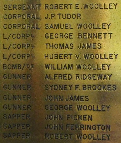
Photo of part of a brass tablet, a Roll of Honour naming 40 men from Waters Upton parish who served during the First World War, and survived.
Part of the Roll of Honour brass in the porch of Waters Upton St Michael, showing six of the 10 Woolley men named on it (and one of the four Bennetts).

The ultimate example of surname borne by a ‘faithful family’ however was Woolley, the clear leader of the Top Ten chart. All 52 of Waters Upton’s Woolleys enumerated from 1841 to 1921 were descended from, or married to men descended from, William Woolley (baptised in 1759 at High Ercall) and Elizabeth, née Downes (probably the one baptised at Waters Upton in 1760).

In conclusion, although the idea of compiling a ‘Top Ten Surnames of my One-Place Studies’ article seemed like a bit of fun, I found the exercise to be fascinating. It focussed my mind on Waters Upton’s census data and made me analyse it in new ways, generating a number of ideas for further study in the process.

Towards a house history of… Lower House (Part 1)

Lower House, a three storey, red brick farmhouse, stands on the northern edge of Waters Upton village, on the West side of the road leading to Harebutt Bank and beyond. A report ⇗ produced for Telford and Wrekin Council in 2009 described the building as “an important introduction to Waters Upton” to those approaching the village via that road. It has stood there, silently greeting residents and visitors alike, since at least the 1700s – with the possibility that it, or an earlier building with the same name, performed that role even further back in time.

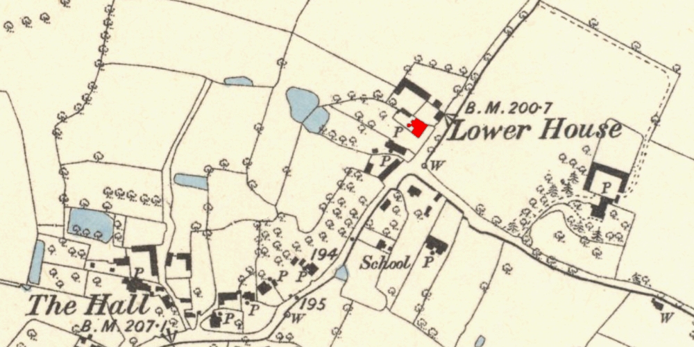
An extract from a large-scale Ordnance Survey map published in 1886 showing part of a village with its buildings, roads, ponds, field boundaries and trees. Lower House is named, and has been coloured red. Other buildings named are a school, and The Hall.
Extract from a 6 inch to the mile scale Ordnance Survey Map (published 1886) showing the North-east end of the village of Waters Upton. Lower House has been coloured red. Map reproduced with the permission of the National Library of Scotland ⇗ under a Creative Commons licence ⇗.
A List entry and a Chancery decree roll…

Because of its special architectural or historic interest, Lower House was listed on 8 Apr 1983. It is categorised as Grade II, with its list entry ⇗ (on the Historic England website) providing basic details of the building, and of the features which make it of special interest.

The List entry suggests that Lower House is an eighteenth century house which was remodelled in the early nineteenth century. I say ‘suggests’ because List entries are not always accurate ⇗ when it comes to the ages of the buildings they describe. And, as I noted above, there might be evidence of the Lower House – or at least a Lower House – existing at Waters Upton in the seventeenth century.

That evidence is in a Chancery decree roll held by The National Archives at Kew. I would have been blissfully unaware of this document, were it not for the Anglo-American Legal Tradition ⇗ website, a treasure trove of photos depicting TNA’s Medieval and Early Modern documents. Abstracts of the contents of many of those photos have also been created, and are searchable – which is how I discovered, via a site search for ‘Waters Upton’, the earliest mention I have found so far of Lower House.

C78 1723 ⇗ is the name of the page containing the aforementioned mention. C78 ⇗ is TNA’s reference for their collection of Chancery decree rolls, and 1723 is the year of the roll in question. An entry on that roll ⇗ dated 4 May in 1723 recorded details of a dispute over property including “all that other Messuage or Tenemt. called the Lower House in Waters Upton”.

The Chancery decree roll contains details of a number of legal documents relating to Lower House, including indentures dated the 25th and 26th June 1697. Those indentures related to “the Lower House or Hughes House“ – the latter name providing a possible clue as to the identity of the original owner of the property.

Was this the same building as the remodelled house of the same name that stands in Waters Upton today? Or was it an earlier abode, on the same spot or even elsewhere in the village, which has not survived? Given the issues with estimated building dates English Heritage listings, I suspect the former.

Brick dentil eaves and voussoired lintels…

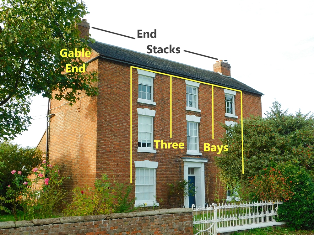
A photo a three storey, three bay, red-brick house, seen at an angle so that front of the house faces slightly to our right, and the side wall faces slightly to our left. The photo is annotated to highlight three architectural features: the two end stacks, a gable end, and the three bays.

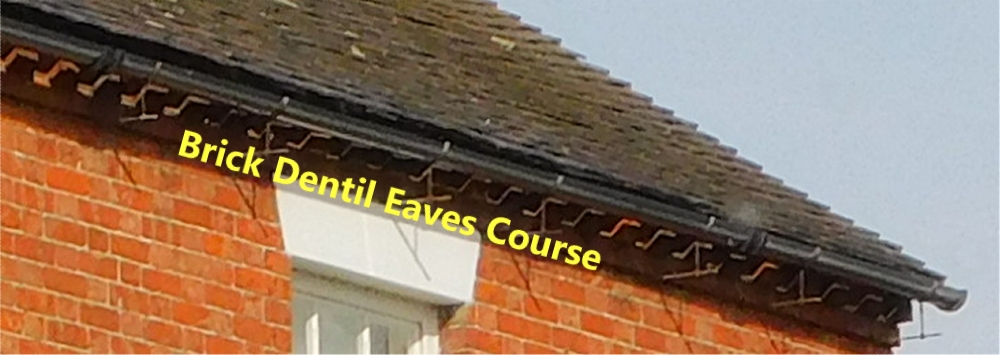
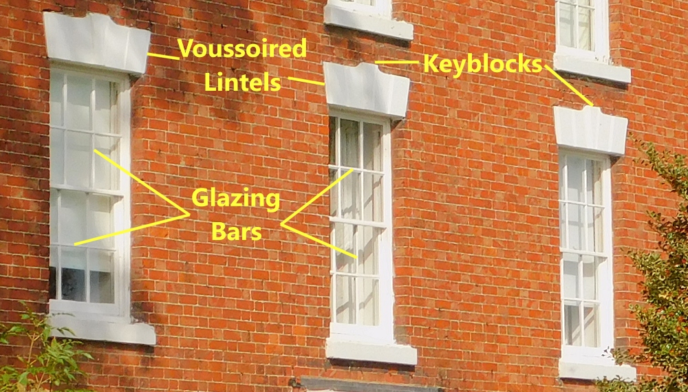
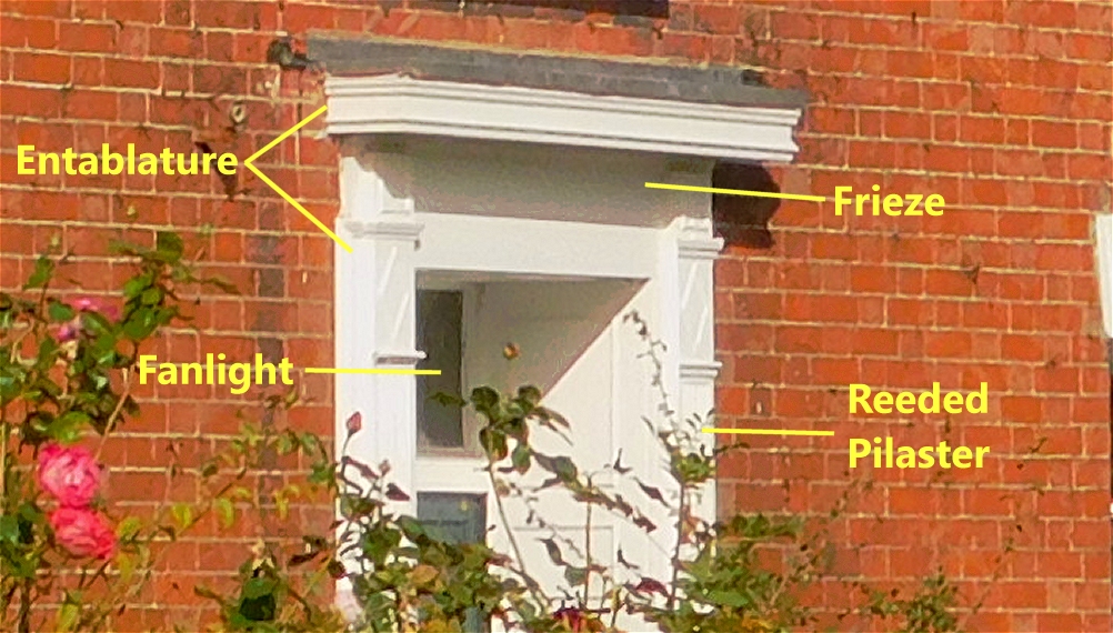
The List entry’s description of this dwelling’s architectural features is something we can be more certain about. Lower House is a three bay, three storey, red brick structure, with a tiled roof which has gabled ends and brick end stacks. Beneath the eaves of the roof is a brick dentil eaves course, with bricks sticking out in tooth-like fashion. (Hopefully the labelled pictures I have provided will help with interpreting some of these architectural terms; you may also find this glossary ⇗ useful.)

A photo showing part of the roof on a red-brick house. The photo is annotated to highlight the brick dentil eaves course at the top of the wall just below the roof.

The sash windows have glazing bars to create the appearance of multiple panes of glass. Above the windows are voussoired lintels with keyblocks.

A photo showing three windows in the wall of a red-brick house. The frames and the lintels above are painted white. The photo is annotated to highlight the following features: glazing bars on the windows; voussoired lintels above the windows; and keyblocks in the middle of the lintels.

The central front doorcase has a reeded pilaster on either side, topped by an entablature with a panelled frieze. There are also panelled reveals and, above the panelled door, a rectangular fanlight. Apologies for not having a great photo of the door – when photographing the house I had no idea I would one day use the images in the way that I am now doing!

A photo showing the top half of the front door of a red-brick house. The door and frame are painted white. The photo is annotated to highlight the following features: a reeded pilaster; a fanlight; an entablature; and a frieze.

Structural elements of the late nineteenth century front garden are included in the List entry for Lower House. There is a dwarf brick wall with stone coping, and a fence of wrought iron railings with spear heads, at each end of which is a matching gate.

Earth Closet, Coal House, Tool House, Pig Pens…

Lower House as a messuage ⇗ (to use one of the terms used in the 1723 decree roll mentioned above) has always consisted of more than just the house itself. There are also the outbuildings and land that goes with it.

The indentures of June 1697 mentioned above refer to the following (I have added punctuation for ease of reading): “buildings, Barnes, Stables and other out buildings, Yards, Gardens, Orchards, Backsides, Lands, Meadows, Leasows, Pastures, Feedings, Woods, Woodgrounds, Fishings, Comons, Comon of Pasture, Turbary, Ways, Waters, Easements”.

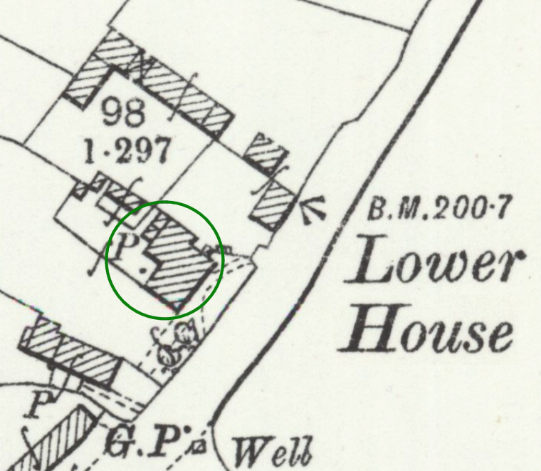
Large-scale Ordnance Survey maps, produced from the latter part of the 1800s onward (the one below was published in 1901) also show several outbuildings. What were they though? Thanks to the Valuation Office Survey, we know what almost all of them were (apart from one or two written illegibly) as of 1910-11. The relevant field book entry recorded the following structures:

  • Earth Closet (Brick & Tile)
  • Coal House (Wood & Iron)
  • Tool House
  • 3 Pig Pens
  • Cow Tying for [6?] + 4
  • 2 Bay Cart Shed & Granary over
  • Barn
  • Cow Tying for 5
  • Root House
  • Cow Tying for 5 & Loft over
  • Stable for 2
  • Trap House
  • Loose Box & [Hack Stable?] for 1
  • 2 Bay Cart Shed (Brick & Tile; Fair)
Extract from a large-scale Ordnance Survey map published in 1901. It shows a road running from the near the bottom left corner to near the top right corner. To the left side of the road field and property boundaries are shown, along with houses and other buildings. Lower House is named on the map extract, and I have added a green-bordered to highlight its position. The positions of two water pumps, a guide post, an Ordnance Survey bench mark and a well  are also shown on the map.
Extract from a 25 inch to the mile scale Ordnance Survey Map (published 1901) showing Lower House (circled) and surrounding buildings and structures at Waters Upton. Map reproduced with the permission of the National Library of Scotland ⇗ under a Creative Commons licence ⇗.
I hope to write in more detail about earth closets, cow tyings, root houses and other buildings enumerated by the Valuation Office Survey, in a separate post at a later date. For now, I will simply say that a recent estate agent’s brochure ⇗ lists the Lower House’s outbuildings as a converted barn (laid out as a home office with WC and kitchen), three garages, and a workshop. Also, the earth closet has long since been replaced by indoor WCs!

Dining & Drawing Rooms, Kitchen, Back Kitchen…

The Valuation Office Survey, which noted that the main house was of brick and tile, and in fair condition, also detailed the rooms inside it:

  • Dining & Drawing Rooms
  • Kitchen
  • Back Kitchen
  • Pantry
  • 4 Bedrooms
  • 2 Attic Rooms
  • 1 Cellar

There is still a dining room and a drawing room, according to the aforementioned estate agent’s brochure. That brochure also shows a number of changes to the functions of some of the rooms. The ground floor featured a kitchen/breakfast room, a family room / playroom, a utility room, a boot room and an integral double garage. Upstairs meanwhile, it appears that one of the bedrooms on the first floor had become a family bath/shower room, while the attic rooms, the second floor of the house, had been converted into two bedrooms and a bathroom, with a study area on the landing.

So, who lived in a house like this (to paraphrase the catchphrase used in TV show Through The Keyhole)? That is a question I will return to in future posts.

To be continued.