My first blog post for the tenth anniversary of Society for One Place Studies ⇗ in 2023 looked at one of Waters Upton’s lanes. A minor road, it runs from the Northeast end of Waters Upton village to a tiny settlement in the south-eastern corner of the parish, The Terrill. The name of this lane – and of some of the fields lying close by – has been written in a variety of ways over the years, and I had a feeling there might have been as many as ten different spellings. I did indeed find ten versions and so I was able to write a post to which the #OnePlaceStudies10 hashtag applied. This is a revised and expanded version of that post.
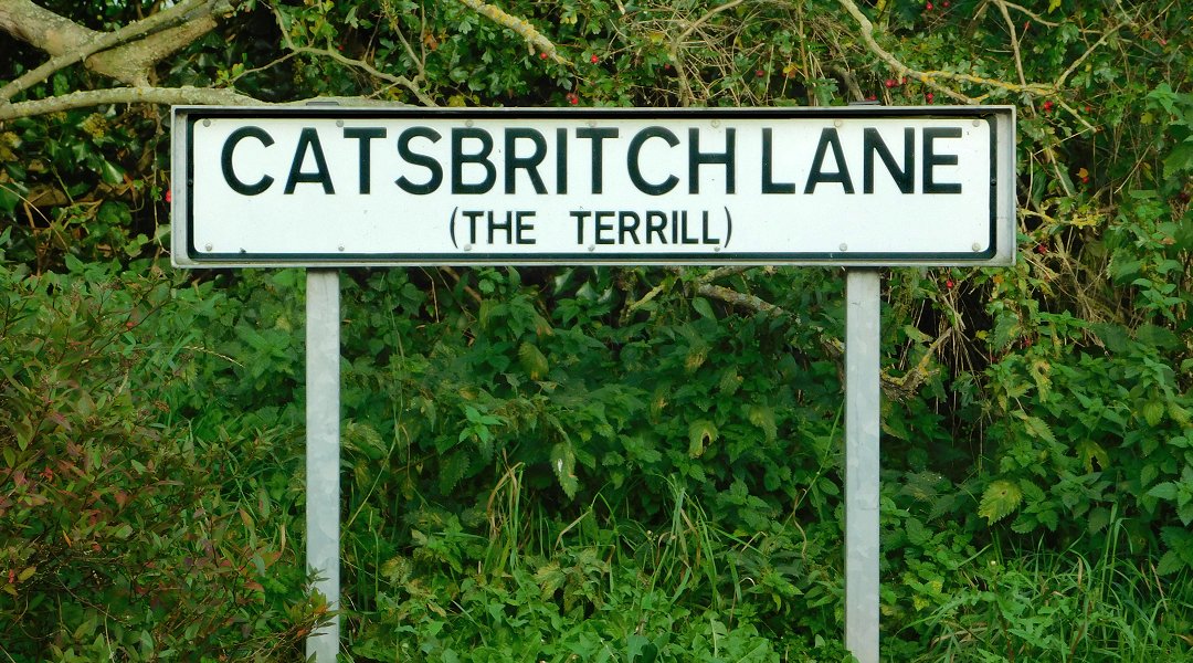
Here are all the names for the lane in question, and features sharing its name, that I have found so far:
- Caspich Lane – The earliest written references I have found for this lane were in the records of baptisms which took place at Waters Upton on 10 October 1782 and 20 April 1788. The first was of Ann, daughter of John and Ann Ouls, the second was of Ann’s brother Thomas (with the family’s surname written as Houls). I will return to these register entries shortly.
- Casprick Lane – This was the place of residence given in the parish register for Edward and Ann Davies, when their daughter Mary was baptised on 17 Dec 1809.
- Castpit Lane – We’re looking at the parish register again, but have jumped forward to the 1850s. Samuel, son of William and Ann Matthews of “Castpit-lane” was baptised on 14 Jul 1850, while Ellen, daughter of Morris and Elizabeth Evans of Castpit lane was baptised on 5 October 1856.
- Caspit Lane – Within three months of the above ceremony, on 4 January 1857, there was another baptism in which the lane, with another variation of its spelling, was given as the family’s abode. The child was Mary Ann, daughter of John and Elizabeth Skitt.
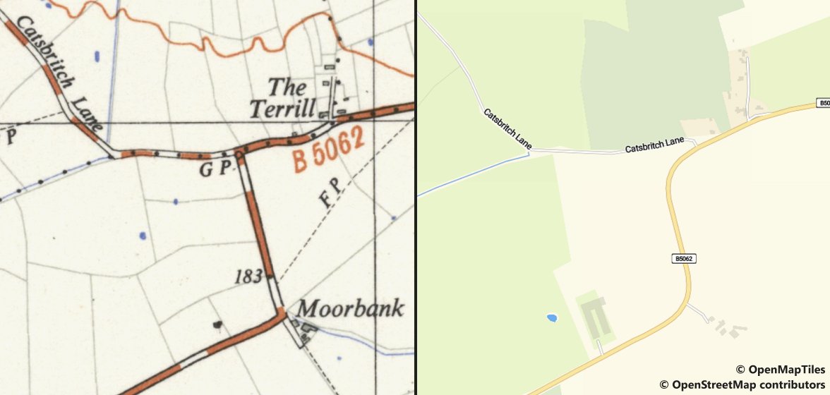
- Catsbritch – Part of a ‘double name’ (Far Britch and Catsbritch) for a parcel of land near the lane, recorded on the Tithe Apportionment Schedule of 1837. This spelling, applied to the lane, later appeared on one of the Ordnance Survey’s 25 inch to the mile maps ⇗ covering part of Waters Upton parish, published in 1902. It then became more or less fixed as the standard name and this is the spelling in use today. (The map below is an extract from later Ordnance Survey mapping, at a scale of 1:25,000, published about 1949.)
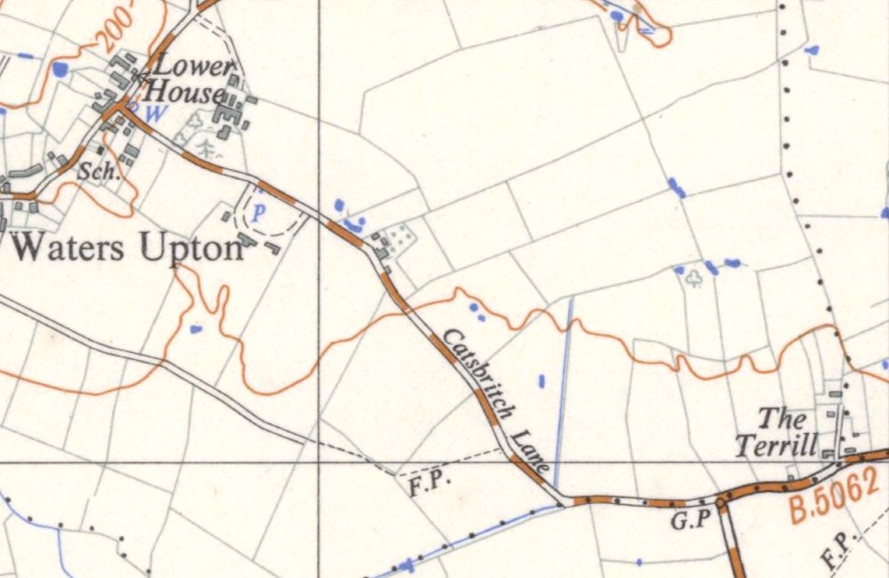
- Casbritch – The Tithe Apportionment Schedule of 1837 also recorded three adjoining fields named Long Casbritch, Far Casbritch, and Near Casbritch (the last-named lying immediately to the West of the lane).
- Castpits Lane – the census of 1871 was the first one on which the name of this lane appeared. The enumerator, describing his enumeration district, referred to it as Castpits Lane – but he also referred to…
- Catsbrich Toll House and Bars / Cat’s Brich Bars – Situated on Castpits Lane, but the name given to the toll house and bars was written with two variants of a different spelling. The first version appeared in the enumeration district description mentioned above, the second version on the page summarising the household census return made on schedule 72.
- Catspit Lane – This version of the lane’s name was first used in 1881, in newspaper notices of the sale of the furniture and other effects of the late Thomas Lloyd. Two more census enumeration district descriptions – in 1891 and 1901 – also featured this particular spelling.
- Gaspit Lane – The address in Waters Upton given for a Mrs Jones, who advertised in 1893 for a “healthy Child, few months old” to whom she would provide a good home in a healthy place on moderate terms.
- Cats Birch Lane – When field books were compiled as part of the survey of Waters Upton under the 1910 Land Valuation Act, another variant spelling came into being. This one appeared in the entries for 5, 6 and 7 Waters Upton (field book ref 613).
- Catsbrick Lane – The Ordnance Survey might have made Catsbritch Lane the definitive version of this road’s appellation in 1902, but that didn’t stop 1921 census enumerator Edgar Percy Davies from going his own way. He used this spelling in his brief description of the Waters Upton enumeration district.
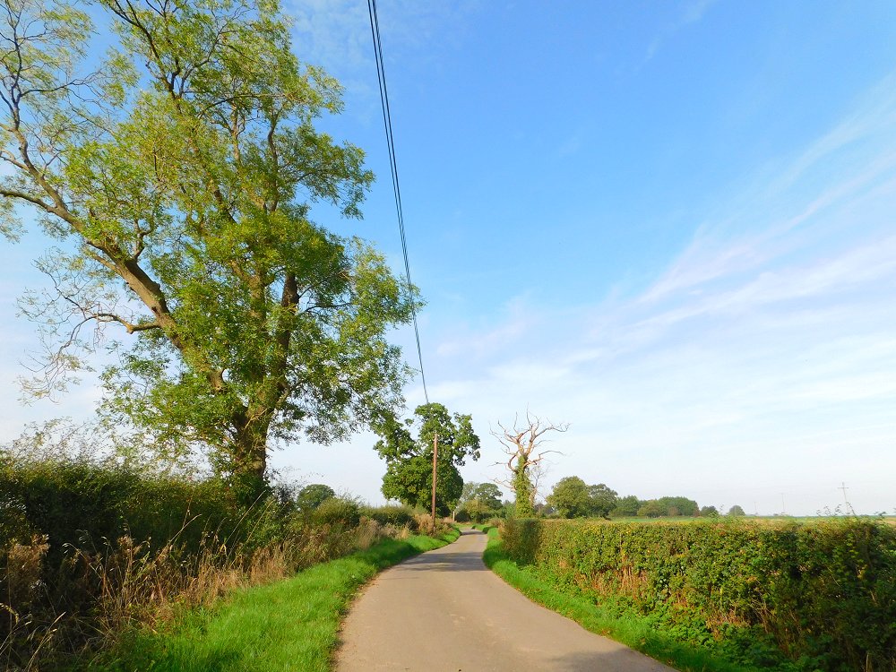
To summarise, over the course of 140 years of written records, the first part of this lane’s name evolved from ‘Cas’ to ‘Cats,’ with ‘Cast’ and ‘Gas’ also appearing. The second part meanwhile changed from ‘pich,’ to ‘pit’ and ‘pits’ (with the variant ‘spit’), and ultimately to ‘brich’ and ‘britch’ (with variants ‘birch’ and ‘brick’). Many of these spellings can probably be explained by people writing down what they heard (or thought they heard) when the name was given to them. And we cannot rule out the possibility of typos occurring, when the name appeared in print.
Origin story
What might the origins of this lane’s changeable name be – could its etymology be enlightening? I decided to approach this line of enquiry backwards, as it were, by starting with the second part of the name.
One obvious possibility is that the name referenced a pit or pits of some kind. The 1837 Tithe Apportionment Schedule for Waters Upton included two fields described (in whole or in part) as Kynnersley Pit. There was also a single parcel of land called Great Britch & Marlpit Croft. This suggests the potential for there to have been a marl pit, or perhaps a claypit (a source of raw material for bricks), which has since vanished or which survives as a pond, after which the lane from Waters Upton to The Terrill was named. There are certainly several ponds in the fields on the North side of the lane.
The ‘Great Britch’ element of that last-mentioned field name points in another direction however. Including those already mentioned, there were in total 16 parcels of land in Waters Upton parish which had ‘Britch’ as part, or as the whole, of their names: Britch x 4, Long Britch x 2, Upper Britch x 2, and one each of Lower Britch, Britch Head, and Far Britch. All of them lay in the south-eastern part of the parish near – or right next to – the road now known as Catsbritch Lane, and all were arable fields.
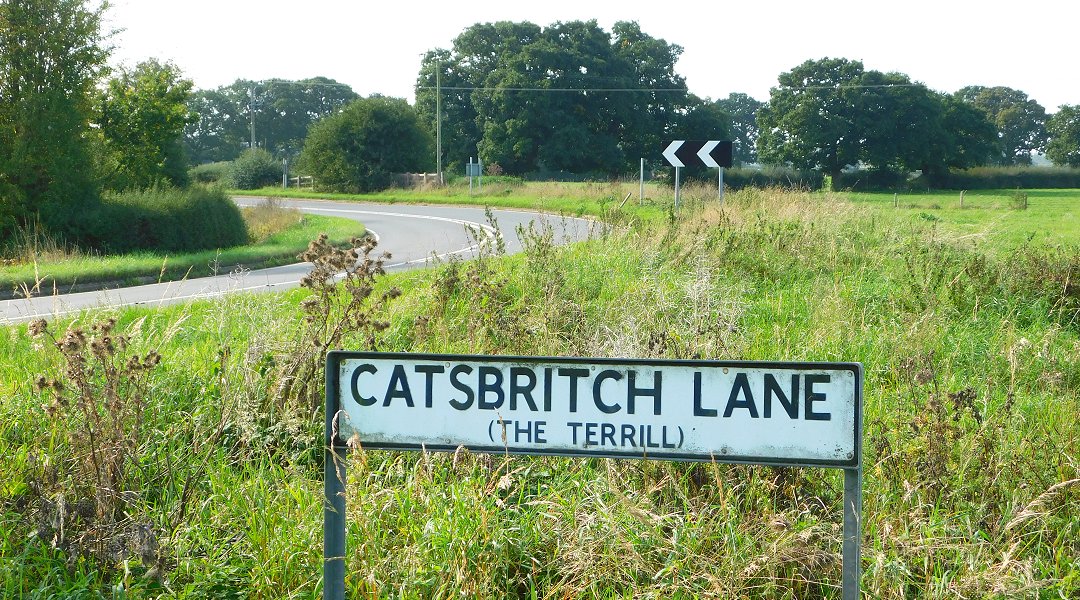
Internet searches led me to various useful sources including a thesis by David Horovitz, A survey and analysis of the place-names of Staffordshire ⇗. From these I learned that the word britch (and variants of it including brache, breche, bruche, brych and even bridge) occur in many other place names in England. It is derived from an Old English word referring to land recently cleared or broken up for cultivation, and there are examples of it being used in conjunction with personal names.
So Catsbritch Lane may have a name with origins going back several hundred years – to a time when the uncultivated land it led to, perhaps belonging to someone with the Old English personal name Catt, was cleared and broken up, ready to be planted with crops.
The end of the road
Where does Catsbritch Lane end, and has that changed over time? Following road improvement works, the Easternmost end of Catsbritch Lane is clearly marked at its junction with the road between Crudgington and Cherrington, part of the B5062. (That junction is a little further to the East of its original location.) Before those road works, and particularly before the B road designation of the route which (in part) links the aforementioned villages, maybe things were less clear cut.
I was prompted to think about this by the first record of Catsbritch Lane in the list above, the parish register entry from 1782 for the baptism of Ann Ouls (or Houls). That entry referred to “Caspich Lane, Ercal Parish” – in other words, the family’s abode was situated on (or very near) to the lane but in the neighbouring parish of Ercall Magna. The baptism of Ann’s brother Thomas gave only the name of the lane, so was the earlier reference to Ercall an error? Or was there a dwelling on the Ercall side of the lane, presumably in the vicinity of The Terrill where the Waters Upton – Ercall Magna parish boundary ran along the centre of the highway?
There is another Houls family baptism in the Waters Upton register which is relevant. On 16 Jun 1790 a private baptism was performed for “Joseph, the Son of John & Ann Houls, Crudgington Liby.” (The last word was, I think, an abbreviation of ‘Liberty.’) This placed the Houls family’s abode in the township of Crudgington, in Ercall Magna parish. Where was that abode though? I see three possibilities:
- A dwelling on the South side of Catsbritch Lane, in Ercall Magna parish, which was pulled down before it could be mapped in the 1800s (just as dwellings further West on the lane and within Waters Upton parish, which survived until the tithe map was drawn up in 1837, were demolished at some point during the years that followed)
- A dwelling known (at least in and after the 1800s) as The Spring, to the East of The Terrill and just inside the Ercall Magna parish boundary
- Moorbank, south of The Terrill (which would mean that the name Catsbritch Lane extended down the road leading to that place
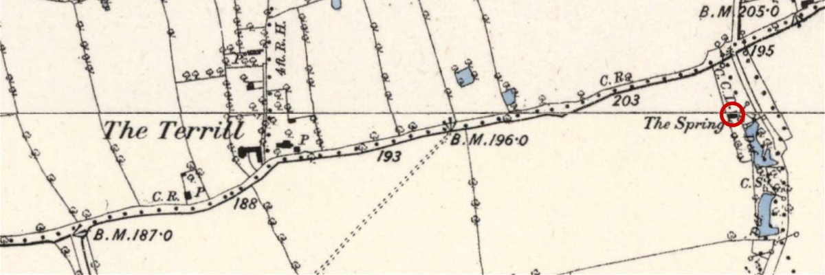
The first two possibilities would be difficult to either prove or disprove, but the third can probably be ruled out. From 15 Feb 1774 to 20 May 1788 baptisms were recorded in the Waters Upton register for children of William and Jane Bennett of Moor Bank. If the Houls family also lived there, their place of residence would surely have been recorded in the same way.
So, although there is no definitive proof, I think it is entirely possible that people in the past applied the name Catsbritch Lane (or variations of it) not just to the lane leading up to the junction with the Crudgington – Cherrington road but beyond that point, at the very least as far as The Terrill, and perhaps all the way to Shray Hill.
Picture credits. All photos by the author. All maps reproduced with the permission of the National Library of Scotland ⇗ under a Creative Commons licence ⇗, except for OpenStreetMap / OpenMapTiles mapping (indicated above), used under a Creative Commons licence ⇗.