A puzzling postcard from Waters Upton

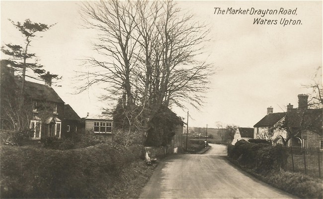
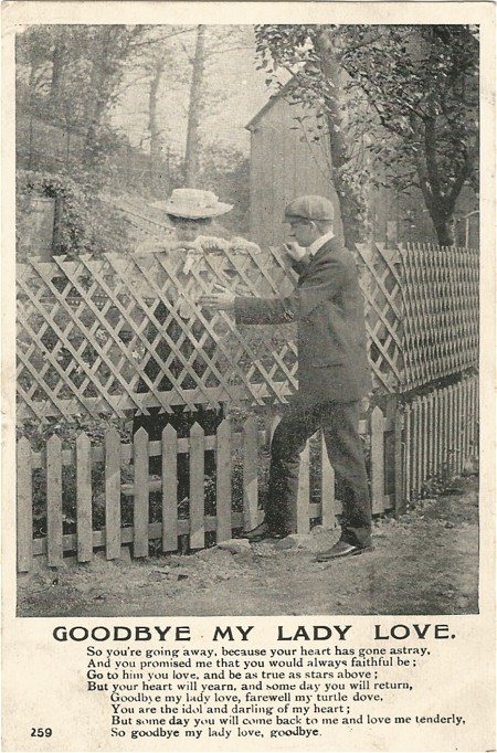
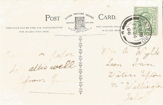
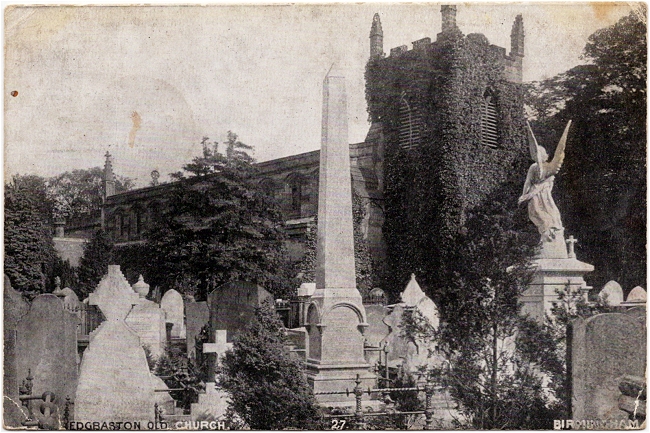
A little while ago I bought a postcard which bears a Waters Upton postmark. It does not add to my limited collection of village views – the scene on the rather grubby front of the card depicts Edgbaston Old Church, Birmingham. But it was probably posted by someone living in Waters Upton, or at least close enough for their mail to be franked there, someone named Elizabeth. Who was she?

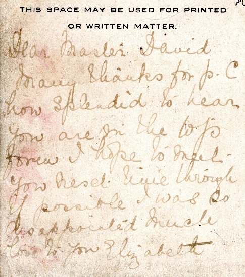
“Dear Master David” wrote Elizabeth, “Many thanks for P.C how splendid to hear you are in the top form I hope to meet you next time through [= though?] if possible I was so disappointed Much love to you”. The postcard was franked on 11 May 1908.

The recipient

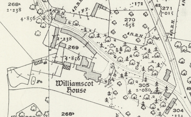
At least the identity of the postcard’s recipient was fairly easy to establish. The card was addressed to Master D. G. Loveday, care of W. Deedes Esq, Mill Mead, Shrewsbury. At the top of the list of results when searching the 1901 census at Findmypast for D* G* Loveday is 4-year-old David G Loveday. He was living at the Manor House in Williamscote, in the Oxfordshire parish in which he was born: Cropredy.

The birth of David Goodwin Loveday, mother’s maiden name Cheape, was registered in the second quarter of 1896 in Banbury registration district ⇗. Googling David’s full name generates results from Wikipedia ⇗ and other websites, showing that he was born on 13 April 1896, was educated at Shrewsbury School, and was an Anglican bishop who died 7 April 1985.

I decided to find out more about David Loveday and his family in the hope that this might help to reveal the identity of Elizabeth. David’s father was John Edward Taylor Loveday. John was born in the first half of 1845 at East Ilsley in Berkshire, where his father (as per the censuses of 1851 ⇗ and 1861 ⇗) was Rector. He seems to be best known for printing, “with an Introduction and an Itinerary”, a manuscript by his great grandfather John Loveday ⇗: Diary of a Tour in 1732 through parts of England, Wales, Ireland, and Scotland. (This tour was probably number 23 in a list of 126 Tours by John Loveday ⇗ compiled by some of his descendants.) He was educated at Exeter College, Oxford ⇗, where he matriculated on 11 June 1862, aged 17.

John Edward Taylor Loveday married ⇗ Edinburgh-born Margaret Cheape on 15 Oct 1874 at Cameron, in Fife, Scotland. The couple made their home at Williamscote House (the above-mentioned ‘Manor House’), where they were enumerated with their first five children in 1881 ⇗. John was described as a “Landed Proprietor & Magistrate for Counties of Oxford & Warwick”. They had five more children over the course of the next 15 years, of whom David Goodwin Loveday was the youngest.

It turns out that David was not the first of the Loveday children to spend time in Shrewsbury. The 1901 census ⇗ records his brother Henry Dodington Loveday, then aged 20 and an articled clerk to a solicitor, lodging with the family of clergyman William Leeke at the Abbey Foregate Vicarage. Another brother, Alexander, was also living in Shrewsbury when the 1901 census ⇗ was taken. Aged 12, he was boarding at the school his brother David would later attend, Mill Mead, a private establishment under the headmastership of Wyndham Deedes.

Elizabeth . . . who?

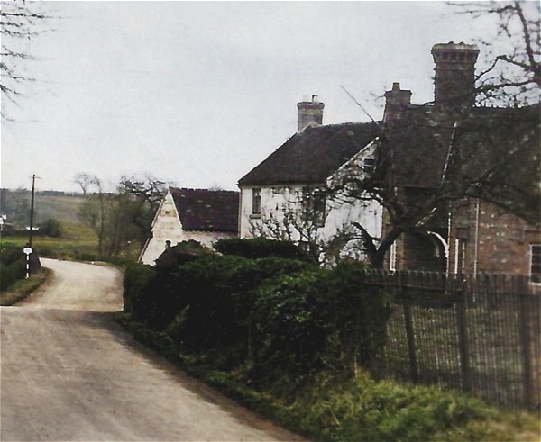
The Lovedays’ connections with Shrewsbury might explain how the mysterious Elizabeth became a friend of the family. Was there a lady of that name living in Waters Upton in the early 1900s who looks like a suitable candidate? Of the several Elizabeths on the 1901 and 1911 census returns for the parish, one stands out: Elizabeth Yonge.

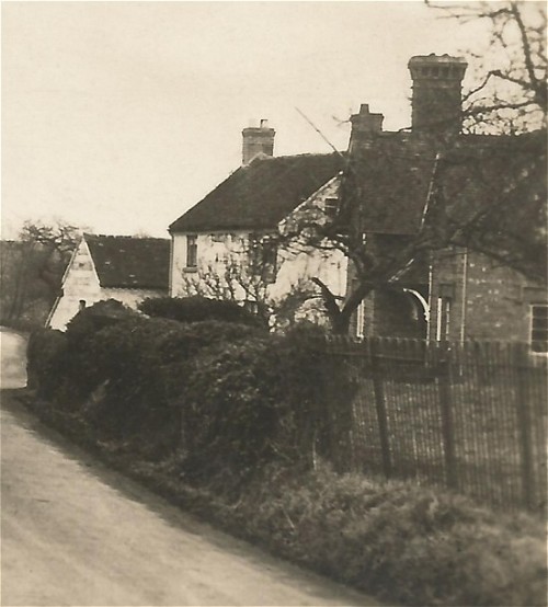
Elizabeth Mary Hombersley Yonge, née Groucock, was the wife of the Rev Lyttleton Vernon Yonge. Rev Yonge was a son of Vernon George Yonge, also a clergyman, and part of a prominent Staffordshire family which had its seat at Charnes Hall. Lyttleton was born at the Rectory in Great Bolas, received his education at Cambridge, and although he resided at Waters Upton he was vicar of Rowton, in Ercall Magna parish. Elizabeth, who was also from the parish of Bolas Magna, was a daughter of Thomas Groucock (a farmer of 180 acres in 1881), and of Elizabeth Groucock née Dickin, who was descended on her mother’s side from the Wase family of Waters Upton Hall.

The social standing of the Yonges (and perhaps also the subject of the postcard’s picture) makes Elizabeth my top ‘suspect’ in a case which is not so much a ‘whodunnit’ as a ‘whopostedit’. All I am lacking is any direct evidence that the Yonges and the Lovedays actually knew each other!

The front of the postcard sent to Master D G Loveday by Elizabeth.

Maybe one day I will find that David Goodwin Loveday’s early education, before he went to Shrewsbury School, was as a pupil boarding either with Lyttleton Vernon Yonge or with his fellow clergyman and Waters Upton resident, John Bayley Davies? Or perhaps I will find a document written (or least signed) by Elizabeth, so that I can compare it with the writing on the postcard at the centre of this mystery. Her signature should appear in the Waters Upton marriage register, but the register begun in 1837 is still in use and has not been deposited at Shropshire Archives. The probate copy of her will, a digitised version of which I have obtained from HMCTS via the Gov.UK website ⇗, is typewritten and bears no signature.

So is this the end of my investigation? Not quite. Because while looking at the other Elizabeths of Waters Upton, I found a further line of enquiry.

Coincidence or connection?

The Elizabeth who piqued my interest was Elizabeth Emma Ball. She was a daughter of William Abraham Richard Ball and his wife Sarah, née Cureton. This Elizabeth spent the early part of her adult life working as a servant before moving back to Waters Upton between 1901 and 1911. There is nothing to suggest that she met the Lovedays unless perhaps she worked for one or more of them as a servant, but if that was the case the development a postcard-exchanging relationship with David Goodwin Loveday seems unlikely. However, if she didn’t know the Lovedays personally, Elizabeth may have known of them, through her younger sister…

Mary Ann Ball was born at Waters Upton on 13 February 1877. By 1891, when she was 14, she was in service, working as a nurse for the family of John Bayley Davies at Waters Upton Rectory. A decade later she was in Shrewsbury, living and working as a housemaid at a house in Belle Vue Road. Then, in 1909, she married Thomas Henry Kimnell.

Thomas was born at Wardington in Oxfordshire on 25 August 1878 and was enumerated there with his family on the censuses of 1881 ⇗, 1891 ⇗, and 1901 ⇗. When the latter census was taken, Thomas was 22 and, like his father, he was an agricultural labourer. Whether his fortunes changed before or after his marriage is unclear, but change they most certainly did. The 1911 census ⇗ recorded him not as a labourer but as a farmer, working on his own account. With wife Mary Ann and daughter Eva Mary (born 14 March 1910) he was living at Williamscote in Wardington parish.

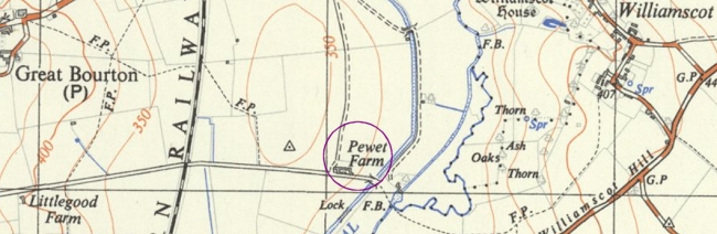
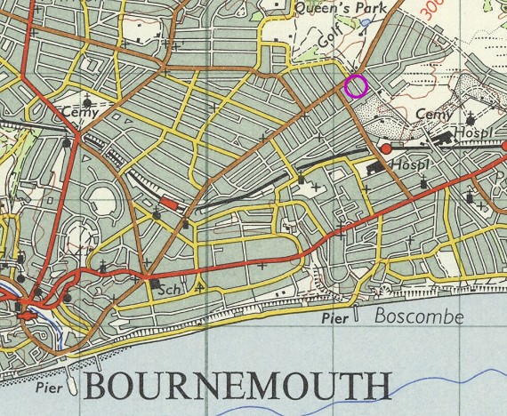
A second daughter, Helen Elizabeth, was born at Williamscote on 22 February 1914, but the Kimnells’ third and last child, Alice, was born at the end of 1917 or in the first quarter of 1918 on the other side of the River Cherwell in the parish of Bourton. Almost certainly the family was living there when the Banbury Guardian of 5 Jul 1917 reported on a military tribunal at which Thomas, a farmer of 107 acres, successful claimed exemption. From the 1921 census and National Identity Register of 1939 it appears that the family remained there for more than 20 years, at Pewet / Peewit Farm (highlighted on the map above).

Thomas Henry Kimnell of Williamscote died on 16 June 1965 at Woodford Halse in Northamptonshire; his estate was valued at £4531. Mary was also of Williamscote at the time of her death on 17 February 1969; given that her death was registered at Daventry she too may have died at Woodford.

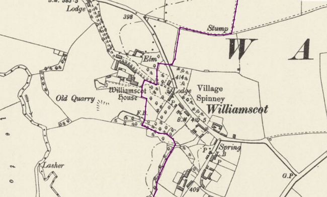
Did the references to Williamscote in the preceding paragraphs cause you to think back to the earlier part of this story, relating to the Loveday family? The hamlet of Williamscote, although lying in the parish of Wardington, is a stones-throw from Williamscote House in neighbouring Cropredy parish (the boundary is shown in purple on the map below). The 1911 Kelly’s Directory ⇗ of Oxfordshire lists Thomas H Kimnell right after John Edward Taylor Loveday under Williamscote! Coincidence? Quite possibly, but I think there’s a good chance that it isn’t.

William Ball was well known in Waters Upton so both the Davies family and the Yonges would have been familiar with his daughters, all the more so in the case of Mary Ann given her employment at the Rectory. If, as I have theorised, Elizabeth Yonge was a friend of the Lovedays, this might mean that she was in a position to help bring about the union of Thomas Henry Kimnell (who the Lovedays may have known, perhaps as an employee?) and Mary Ann Ball.

Ultimately, this is speculation and does not prove anything conclusively. The puzzle of the postcard’s sender remains officially unsolved – a one-place study ‘X File’. At least for now. One further possibility for acquiring a sample of Elizabeth Yonge’s handwriting and/or signature remains. Dave Annal recently reported on Twitter that he managed to obtain a copy of an original will from HMCTS – although he did have to wait 16 months!


Picture credits: Front and back of postcard, author’s own images. Extract from Ordnance Survey 25 Inch mapping (1892-1914) showing Williamscot House ⇗ reproduced with the permission of the National Library of Scotland ⇗ under a Creative Commons licence ⇗. Extract from Ordnance Survey 1:25,000 mapping (1937-61) showing Great Bourton, Pewet Farm and Williamscot ⇗ reproduced with the permission of the National Library of Scotland ⇗ under a Creative Commons licence ⇗. Extract from Ordnance Survey 6 Inch mapping (1888-1913) showing Williamscot House and Williamscot ⇗ reproduced with the permission of the National Library of Scotland ⇗ under a Creative Commons licence ⇗.

A Waters Upton Postcard

Although I acquired a postcard sent to Waters Upton a little back (see Lucy Alice Wylde and her secret admirer), it is only during the last week that I have finally managed to get my hands on a postcard showing a scene of the village. And here it is: Market Drayton Road, Waters Upton.

A sepia-toned photo scanned from a postcard, likely dating from the early 1930s. Just right of centre, a lane heads downhill, away from our viewpoint; in the middle distance the lane turns to the left and disappears from view. A few houses and other buildings stand on either side of the lane, most of them set slightly back from it. On the right, in the garden of the house there, a tree, probably a Scots Pine, can be seen; in the same garden, within or  just adjacent to the hedge marking the edge of the garden next to the lane, is another tree, without leaves.

Where was ‘there’?

Now, of course, I have questions! From where exactly was the photo taken? What can we see in the picture – which houses are they on either side of the road, and in the distance? When was the photo taken? How does the view today compare with the one captured in the photo?

A virtual visit to Waters Upton via Google Street View ⇗ goes a long way towards answering the first and last of my questions. It isn’t possible to match up a ‘now’ Street View to the ‘then’ postcard image exactly, because the Street View camera grabbed its images from the other side of the road. This is the closest I can manage (also, note that this picture is from 2009 rather than ‘now’).


Thanks to the National Library of Scotland’s marvellous map collection, I have also found an Ordnance Survey map showing the layout of the buildings and other features depicted in my postcard. This map, at a scale of 25 inches to the mile, is incredibly detailed. It was published in 1901, based on revisions undertaken the previous year. Whoever took the postcard photo was probably standing somewhere to the south of the spot height of 182 feet marked on the map.

An extract from a large-scale Ordnance Survey map, showing part of the village of Waters Upton. Features shown include a river (the Tern) on the right, a road with houses including the Swan Inn, from which a small road, River Lane, heads more or less Eastward to join another road in the village. In the top right corner is The Rectory, and near the bottom right corner is the Smithy.
Extract from Ordnance Survey 25 Inch Map XXIX.8, Reproduced with the permission of the National Library of Scotland ⇗ under a Creative Commons licence ⇗.

And when was ‘then’?

We’ve seen the scene from around ‘now’, but when was ‘then’? Although a precise answer isn’t possible at the moment, the picture on my postcard is unlikely to correspond to the date of the Ordnance Survey map above. The card was never posted so it doesn’t have a postmark, but there are other clues and they point to a later date than the turn of the century.

The back of the card doesn’t give much away. What little text there is does not name of the company which printed or sold it. All it says is “POST CARD”, with the words “BRITISH MANUFACTURE” below that, “Communication” and “Address” a little lower down on the left and right hand sides, and running up the middle of the card “A Real Bromide Photograph”. I have however seen images online of postcards matching mine in these details, posted around 1930.

I have found more evidence on the Shropshire Star website, in an article from 26 February 2010. Under the heading Pictures from the past ⇗ it shows a black and white image another postcard featuring Waters Upton. This too was taken from the Market Drayton Road, but further to the south. Its title, printed in an identical typeface to that used on my postcard, is Post Office & Garage, Waters Upton. The trees in the photo, like those on my postcard, are bare. I’m willing to bet that the scene was captured by the same photographer, and on the same date, as the one I have. According to the Shropshire Star, the postcard was franked on 21 August 1936.

Life on the edge

So the scene captured on my postcard probably dates from the early 1930s or thereabouts, and is a view taken from the edge of the village and parish rather than from its centre. The photographer was looking north-north-west along the course of the road to the bend, beyond which, just out of sight, it crosses the River Tern and the parish boundary. The road then turned back the other way, following the river and eventually becoming Sytch Lane.

Part of the postcard image at the head of this article. It shows the lane and the point where it turns to the left, and, on its left side, the side of a building, a couple of telegraph poles, and what appears to be a road sign on a black and white pole. Higher ground, and one or two houses, are visible in the distance.

At the point where a road to Rowton branched off was a place known as Waterside. The Ercall Magna poorhouse – later a Wellington Poor Law Union workhouse, and later still the Union’s school – was located there (see Refuges of Last Resort: Shropshire Workhouses and the People who Built and Ran them ⇗, pages 73 – 76). After a new workhouse (with its own school) was completed in Wellington in 1876, the premises at Waterside were sold and became known as the Union Buildings. Can we see one of them, behind the first of the two telegraph poles visible in this picture? And can we see sheets hanging out to dry, to the right of the house? Unfortunately the original image can be only be enlarged so far before it begins to get fuzzy.

An extract from a large-scale Ordnance Survey map. From the bottom edge, on the right, a road and a river (the Tern) run Northward to the top of the map, where there is, on the left side of the road, a cluster of houses and other buildings named Waterside.
Extract from Ordnance Survey 25 Inch Map XXIX.8, Reproduced with the permission of the National Library of Scotland ⇗ under a Creative Commons licence ⇗.

Although the area captured on camera here was not physically in the middle of Waters Upton, it was very much a part of the village’s commercial heart. The Market Drayton road, running between that town and Wellington, was a well-used transport route in this part of Shropshire. For most of those who used it, the part of Waters Upton that lay beside this road was probably the only side of the settlement they saw.

Where everybody knew your name

Taking advantage of the passing trade while also serving the locals, both of Waters Upton’s pubs were situated here. The oldest of the two, the Swan Inn, can be seen on the right hand side of the view in my postcard – the two white-coloured buildings. The 1934 Kelly’s Directory covering Shropshire shows that Joseph Madeley was then the innkeeper. He was still there five years later when the National Identity Register (better known today as the 1939 Register) was taken, with his wife Nellie Ann, née Meller. The 1921 census shows that Swan had seven rooms; the census of 1911 however records nine and the Valuation Office Survey field book entry from 1910/11 lists the following: Tap Room, Smoke Room, Snug, Kitchen, 5 Bedrooms. I will have much more to say about the Swan, its other occupants and some of its customers in future blog posts!

Another part of the postcard image at the head of this article. It shows the buildings on the right side of the lane, behind a boundary fence and then behind a hedge or perhaps an ivy-covered wall. The first and the second buildings are houses of two storeys and have chimneys, the second has white- or lime-washed walls. A further building, of one storey, also has white walls.

Next door to the Swan and closer to our viewpoint is a building which, Google Street View reveals, is named Sutherland Cottage. It was recorded under this name when the 1939 Register was compiled, when it was occupied by Mary Ann Woolley (née Shuker). Mary was the widow of railway ganger / platelayer Samuel Woolley, who died in 1936. His National Probate Calendar entry gave his address as 20 Waters Upton – which corresponds with Sutherland Cottage. It seems likely to me therefore that Samuel was living at Sutherland Cottage, with Mary Ann, at the time when the photo on my postcard was taken. The couple, and three of their children, were also enumerated at 20 Waters Upton on the 1921 census.

Was Sutherland Cottage also the home of the Woolley family when the censuses of 1891, 1901 and 1911 were taken? I think it was. Although the name of the building was not recorded on those censuses (or any prior to them), on all three occasions it was the next household to be enumerated after the Swan – just as it was in 1939. The 1911 census recorded that it contained four rooms in addition to the kitchen. Furthermore, the Valuation Office Survey field book entry from 1910/11, confirming the owner as the Duke of Sutherland and the occupier as Samuel Woolley, records the address as 20 Waters Upton.

The name Sutherland Cottage indicates that the property was built by the Duke of Sutherland ⇗, who was a big landowner in Shropshire – though not in the parish of Waters Upton (the tithe maps and apportionments show that his holdings there were very small). Duke of Sutherland cottages, though not identical to each other, seem to have had a particular character; here is a great example from Burlington near Crackleybank in Shropshire.

A colour photo of a two-storey, three-bay, brick-built house or cottage, which has extensions to its far side and to the rear, and chimneys. The lower parts of the house are partially obscured by a garden hedge.
Cottage at Burlington by Richard Law. Taken from Geograph ⇗ and used under a Creative Commons licence ⇗.

Left ‘til last

Across the road from Sutherland Cottage on the left hand side of the photograph, a large brick building can be seen. It has the appearance of something built and used for agricultural purposes rather than as a dwelling. Also on the left-hand side but closer to the camera is a house with a single storey extension and a small wooden building in its grounds. The house is The Beeches (a.k.a. Beech Cottage).

Another part of the postcard image at the head of this article. It shows a two-storey house, with a single-storey extension to the far side and at least two additional buildings, including road abutting the lane on the right. Between the main house and the road is a garden, bounded by what appears to be a low hedge. At the far end of the hedge, close to the aforementioned roadside building, is a tall, leafless tree (a Beech?). There is another tree on the right side of the image, possibly a Scots Pine.

The 1934 Kelly’s Directory covering Shropshire and the 1939 Register show that The Beeches was then occupied by John Brookes, a farmer or smallholder, and his wife Emily (née Fletcher). It was listed immediately after the Swan and Sutherland Cottage on the 1939 Register – and in the same way (with the same name!) on the enumerator’s summary schedule for the 1911 census. The house was however recorded between the two aforementioned properties on the 1921 census. This is the earliest census showing John Brookes, and Emily (then housekeeper Emily Fletcher), as residents of The Beeches.

In 1911 the house was occupied by John Shakeshaft, a corn merchant, along with his wife Elizabeth (née Taylor) and their sons Joseph and Robert. (Curiously, the Valuation Office Survey field book entry from 1910/11 lists the occupier as Robert Shakeshaft.) As with the Woolley family, it appears that the Shakeshafts were living in the same house in 1901 and 1891 as the one they occupied in 1911. John was described as a general merchant in 1901 and as a corn and coal merchant and farmer in 1891. On neither of these censuses was the house named, but as would happen in 1911 and 1939 it was enumerated immediately after the Swan and Sutherland Cottage. I suspect it was also where the Shakeshafts lived in 1881 (their first appearance on a census at Waters Upton), even though their household did not appear on the census schedule in the same sequence as in later years. John was then a corn merchant and farmer of 12 acres. He died in 1919.

And now for something completely different?

As we have seen from Google Street View ⇗, things have changed in the eighty to ninety years since the photograph on my postcard was taken – though thankfully not so much as to make the view unrecognisable. Among the most noticeable changes are:

  • The loss of the Scots pine, the deciduous trees and the wooden building, adjacent to the house which may have been The Beeches (and the appearance of non-native conifers in the vicinity)
  • The flattening of that dip in the road, and the addition of road markings
  • The loss of the smaller of the two white-coloured building that made up the Swan Inn
  • Since the Street View camera’s visit, the gutting of the Swan by fire 2015 (the front face of the building remains but the roof and much else has gone; the Shropshire Star reports ⇗ that plans have been submitted to build houses and a community centre on the site)
  • The replacement of the roadside hedges at the front of The Beeches (?) and Sutherland Cottage with walls (or the removal of vegetation which had obscured walls which were there all along?)
  • The loss of the view beyond the bend in the road due to growth in roadside hedges and trees

A further change, out of sight, is that Sytch Lane and the stretch of road leading up to it has been bypassed. The ‘Market Drayton Road’ is now referred to (at least by the Shropshire Star in the report linked to above) as Long Lane, and it is classified as the A442, which goes to Whitchurch. At Hodnet however, it briefly merges with the A53 and that road takes travellers to Market Drayton.

Finally, on the subject of changes, how about a conversion of the sepia tones of the original Bromide photograph into colour? Here is the result of using the MyHeritage In Color™ ⇗ tool, and tweaking the result in Paint Shop Pro.

A colourised version of the sepia-toned photo at the head of this article. Just right of centre, a lane heads downhill, away from our viewpoint; in the middle distance the lane turns to the left and disappears from view. A few houses and other buildings stand on either side of the lane, most of them set slightly back from it. On the right, in the garden of the house there, a tree, probably a Scots Pine, can be seen; in the same garden, within or  just adjacent to the hedge marking the edge of the garden next to the lane, is another tree, without leaves.
A colourised version of a part of the postcard image at the head of this article. It shows a two-storey house, with a single-storey extension to the far side and at least two additional buildings, including road abutting the lane on the right. Between the main house and the road is a garden, bounded by what appears to be a low hedge. At the far end of the hedge, close to the aforementioned roadside building, is a tall, leafless tree (a Beech?). There is another tree on the right side of the image, possibly a Scots Pine.
A colourised version of a part of the postcard image at the head of this article. It shows the lane, on the left side of the image, and the buildings to the right of the lane, behind a boundary fence and then behind a hedge or perhaps an ivy-covered wall. The first and the second buildings are houses of two storeys and have chimneys, the second has white- or lime-washed walls. A further building, of one storey, also has white walls.

Lucy Alice Wylde and her secret admirer

A puzzling postcard

“Has your #OnePlaceStudy been photographed?” As you might guess from the hashtag, this question was posed on Twitter. Pam Smith’s tweet prompted me to make another online search for old photos of Waters Upton, a search which turned out to be fairly fruitful. Not only did I find an old photo, I also happened upon an intriguing postcard sent to a young lady of Waters Upton, from someone who appears to have been a secret admirer.

The pictorial side of an old postcard, described in the text of the article.

The postcard was one of many being offered for sale on the British Family Tree Research ⇗ website, and naturally I soon snapped it up. As you can see, the front of the card has a black and white photo of a young man standing on one side of a garden fence, looking at a young woman standing on the other side. Below the photo the following verse is printed:

GOODBYE MY LADY LOVE.
So you’re going away, because your heart has gone astray,
And you promised me that you would always faithful be;
Go to him you love, and be as true as stars above;
But your heart will yearn, and some day you will return,
Goodbye my lady love, farewell my turtle dove,
You are my idol and darling of my heart;
But some day you will come back to me and love me tenderly,
So goodbye my lady love, goodbye.

Powerful stuff, so let’s go over to the other side of the postcard for the all-important details of the sender and the recipient. The lamenter of lost love was, as I suspected, anonymous. Not only was no name given, the message is almost illegible in places! That message simply said:

Thanks for paper
hope allis [= all is] well
from Your’s

The side of an old postcard bearing a message and the name and address of the intended recipient, detailed in the article.

OK, what about the postmark – a vital clue or a red herring? Well, it shows that the postcard was posted at Watford, in Hertfordshire, on 24 February 1906. Did the sender live in Watford but visit Waters Upton, or live in the latter and visit the former (through employment, or maybe because of family connections), or did the sender live in Waters Upton but know someone who lived in Watford, who agreed to post the card to make its origins more mysterious? The one person whose identity I knew, from the details provided on the BFTR website, was of course the addressee: Miss A Wylde of the Lion Inn, Waters Upton. Without a doubt Lucy Alice Wylde, who was known as Alice – presumably to avoid confusion as her mother’s name was also Lucy.

The life of Lucy Alice Wylde: part 1

Lucy Alice Wylde was born at Waters Upton in 1889, most likely in the Lion Inn; her birth was registered at Wellington in the second quarter of that year. She was the third child and first daughter of John and Lucy (née Strefford) Wylde, and appears with them at the Lion on the 1891 census, along her elder brothers Frederick and Joseph (twins) and younger sister Sarah Ann (aged 7 months).

Sadly, Lucy Alice and her siblings lost their father on 2 April 1900 (a headstone in Waters Upton churchyard surviving to tell the tale). Their widowed mother took on the running of the Lion, and she was enumerated in that capacity on the 1901 census, with her children Frederick, Joseph, Alice (the forename Lucy dropped by that time), Harry and Albert (but not Sarah who, as we will see, was staying elsewhere).

The Wellington Journal of 27 July 1901 shows that Alice took part in the Bolas and Waters Upton Flower Show, held on the afternoon of Friday 6 July. In the Children’s Division of the show she was awarded fourth place for her collection of grasses; if she entered a wild flower bouquet she was not placed. There were also sporting events held in conjunction with the show (reported on in the following week’s edition of the Journal), including egg and spoon races for married ladies and spinsters; Alice competed in the latter and came second.

The next event in Alice’s life that I know of was the delivery of the postcard from her secret admirer, which quite possibly prompted giggles from Alice’s siblings, and maybe blushes from Alice herself? Alice, who at that time was nearly 17 years old, may well have known who the sender was – but we can only guess. Was it perhaps William James or his younger brother Thomas, sons of Alfred James the butcher and his wife Ann, whose household was enumerated immediately before the Lion on the censuses of 1901 and 1911? Even if I had samples of handwriting to compare (sadly I don’t) it would probably be difficult to prove one way or the other. One reader of the first incarnation of this story suggested “a teasing card from female friends or [an] elder brother.”

In an attempt to find out more, I endeavoured to piece together what happened to Alice after 1906. The first part of this project was easy. By 1911 Alice had indeed left home and she was not with her family at the Lion Inn on that year’s census. Like her elder twin brothers, Alice had found railway-related work – she was enumerated at Manchester’s Central Station on Lower Mosley Street (pictured below in the 1910s) where she was one of seven single ladies working as bar attendants.

An old, sepia-toned photograph of Manchester Central Train Station. The station is in the background, the foreground being the street outside, with a cyclist on the road and around 20 people on the footpath.

The life of Lucy Alice Wylde: part 2

Alice’s life after 1911 was something which, at first, I was not 100% certain about. With the aid of Ancestry and then also Findmypast, I tentatively pulled together the following sequence of events. As all the records I have found use her full name, I too will from this point refer to Lucy by her original given name.

In the last quarter of 1919, the marriage of Lucy A Wylde and John Crompton was registered at Wellington, Shropshire. Judging by his surname ⇗, John was probably a Lancashire lad whom Lucy met while working in that part of England; I think it very likely that the couple wed at Waters Upton, which was not only the bride’s native parish but also where her mother still lived and worked.

Very soon after their nuptials, the newlyweds emigrated. The passenger list for the Saxon, departing Southampton on 19 December 1919, included a Mr and Mrs J Crompton who were contracted to land at Cape Town. I have to point out that there are a number of things in this record which suggest that it relates to another couple – Mrs Crompton’s age is given as 20 (30 would have been more accurate), and the “country of last permanent residence” was indicated as being “British Possessions” for both parties (I have found no evidence of any previous periods abroad for either of them). However, Mr Crompton’s occupation was given as “Clerk”, and his age as 35, both of which tie in with later records.

On 31 May 1926 Lucy A Crompton, a housewife aged 37, arrived at London from Cape Town aboard the P&O Steamship Balranald from Sydney, Australia. The country of her last permanent residence was recorded as “Africa” – which of course is not a country. (As one of my former geography teachers said many years ago when someone gave “Africa” as an answer to a question, “Damnit man, Africa’s a big place!”) Lucy’s proposed UK address was the Grapes Hotel in Liverpool, but her intended future permanent residence was “Other parts of the British Empire”. Sure enough, on 2 September 1926, 37-year-old housewife Mrs Lucy Alice Crompton, whose last UK address was the Glasgow Arms Hotel in Deansgate, Manchester, departed London for Cape Town aboard the P&O Steamship Borda. Her country of intended future permanent residence was “S. Africa”.

A further brief visit to the UK was made in 1935. This time, 46-year-old Lucy Alice Crompton was accompanied by her husband, John Crompton, a Secretary, aged 50. The couple, whose last and intended future residences were South Africa and “Other parts of the British Empire” respectively, arrived at Southampton on 29 July, aboard the Carnarvon Castle (pictured below). Their proposed UK address – and these details are worth remembering – was “c/o Mr Doughty, 12 Hayes Ave, Bournemouth”. The Cromptons left just over a fortnight later, on the Carnarvon Castle’s return trip to South Africa which began when it departed Southampton on 9 August 1935.

Black and white photo of a steam-powered passenger liner, with two relatively short funnels, and masts for and aft. The vessel is heading towards the right.

Lucy A Crompton, aged 64, returned to the UK for what appears to have been the last time in 1954. The passenger list for the Edinburgh Castle shows that she arrived at Southampton on 9 April. John Crompton was not with her (I have yet to establish his fate, not to mention who he worked for in South Africa, and whereabouts in that country he and Lucy lived). Lucy was once again heading for 12 Hayes Avenue in Bournemouth – and she intended to remain in England permanently.

According to the National Probate Calendar for 1966, Lucy Alice Crompton of 18 Lansdowne House, Christchurch Road in Bournemouth died on 12 May that year at Christchurch Hospital. Probate was granted to the Westminster Bank, and Lucy left effects valued at an impressive £12,766.

Not a bad life for a publican’s daughter – assuming all the above records actually relate to ‘our’ Lucy Alice Wylde! How to be certain, without purchasing Lucy’s marriage certificate, or her death certificate, or perhaps a copy of the aforementioned will? I decided to follow the fortunes of Sarah Ann Wylde, the younger sister of Lucy, and see what information that turned up.

Wylde at heart: sister Sarah Ann

Sarah, as we have seen, was not with her siblings and her widowed mother at the Lion Inn, Waters Upton, at the time of the 1911 census. Instead, she was staying with her cousin William Lawrence Wylde (a son of Sarah’s late uncle Lewis Wylde) at 52 Stafford Street in Hanley, Staffordshire. William, incidentally, was a Beerhouse Manager, so his (public) house was, aside from being in an urban rather than a rural environment, ‘home from home’ for 10-year-old Sarah.

In my initial searches I failed to find Sarah on the 1911 census, but I managed to catch up with her in 1922 – on her wedding day. The marriage register of Stanmore Church in Middlesex, described by Ancestry as Harrow St John, shows that on 29 June 1922 Sarah Ann Wylde of Stanmore, a spinster aged 31 and a daughter of John Wylde deceased, married Albert Ishmael Doughty of Harrow, son of John Doughty deceased. John, who had retired from business, was a bachelor aged – wait for it – 56 (perhaps there’s hope for me yet!).

Extract from an Ordnance Survey map showing part of Bournemouth. The sea can be seen at the bottom of the map, with three piers jutting out into it. The land shown on the map is almost entirely built up, with grey blocks representing houseing and other buildings, and red, orange and yellow lines representing roads.  There is however some open space, including a golf course, around the top right corner.

Does the surname Doughty ring any bells? If it doesn’t, how about the address where Sarah and Albert were living when the National Identity Register was compiled in 1939? Albert I Doughty, a retired pawnbroker born 26 August 1865, and Sarah A Doughty, born 19 August 1890, were – along with Albert’s unmarried sister Marion – residing at 12 Hayes Avenue, Bournemouth (Hayes Avenue lies within the purple circle on the map above). Boom! Clear evidence that Sarah’s sister Lucy Alice Wylde had indeed married clerk / secretary John Crompton and emigrated with him to South Africa.

Albert Ishmael Doughty of 12 Hayes Avenue Bournemouth died on 28 November 1942; the National Probate Calendar for 1943 shows that probate was granted to the National Westminster Bank and that Albert effects were valued at a whopping £30,883 4s. 3d. His widow Sarah Ann Doughty, née Wylde, remained at the couple’s home in Bournemouth but died at Strathallan Nursing Home in Owls Road on 12 August 1962. She had evidently been the primary beneficiary of her late husband’s will, as her effects (according the National Probate Calendar of 1962) were valued at £26,901 14s. 5d.

So far away, yet so close

Lucy Alice and Sarah Ann, two sisters from Waters Upton, led very different lives, and for a large part of those lives were half a world away from each other. But despite the distance they were clearly very close to each other. Not only did they keep in touch, they also spent their last years in the same seaside resort on the south coast of England.

What of Lucy Alice’s secret admirer? That postcard wasn’t thrown away, it was kept and it was presumably only after Lucy’s death that it found its way into the old postcard trade, so it must have meant something. Well over a century after it was posted, it came to my notice and has led to a little of Lucy Alice’s life, and that of her sister Sarah, being explored and remembered. But who sent the card?

Thanks to genealogy guru Dave Annal (Lifelines Research ⇗), I think we now have a pretty good idea. Dave did a more thorough job of searching for Sarah in 1911 than I did, and guess where he found her? Living (and working as a general domestic servant) in the household of Ellen Hester Boulter at 2 Loates Lane in Watford, that’s where!


Picture credits. Postcard sent to Miss A Wylde: Posted in 1906 and therefore believed to be out of copyright. Central Train Station, Manchester: From a 1910s postcard and therefore believed to be out of copyright. The Union-Castle Royal Mail Motor Vessel “Carnarvon Castle”: From an out-of-copyright image at State Library of Queensland ⇗ (John Oxley Library), Australia. Map of Bournemouth showing the location of Hayes Avenue: Extract from Ordnance Survey One Inch map Sheet 179 ⇗; reproduced with the permission of the National Library of Scotland and used under a Creative Commons licence ⇗.