View maps dating from: 1600s | 1700s | 1820s & ’30s | 1880s | 1900s | 1910s | 1930s | 1940s | 1950s | 1960s | 1970s
Most (but not all) of the images below are larger than displayed on the page; by clicking / tapping on them you can view them at full size. Where images are considerably larger than displayed, and are particularly worth viewing at full size, I have indicated this.
Except where otherwise stated, the maps on this page are reproduced with the permission of the National Library of Scotland under a Creative Commons licence.
1600s
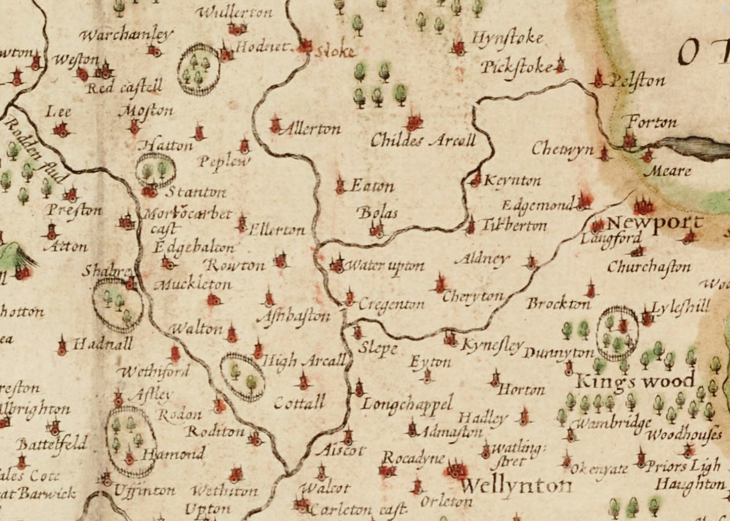
This is an extract from a map of Shropshire dating from around 1605 to 1611, created by John Speed as part of a series of maps entitled Theatre of the Empire of Great Britaine published by John Sudbury and George Humble. Waters Upton is shown amidst other villages and hamlets, with the towns of “Wellynton” (Wellington) and Newport to the south-east and north-east respectively. Click / tap the image to view at full size. Added Nov 2025.
Original image from Newcastle University’s CollectionsCaptured website. There are no known copyright restrictions.
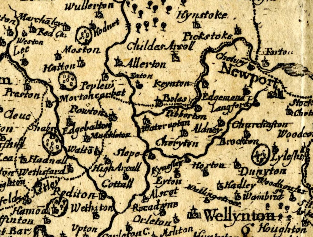
This is an extract from a map of Shropshire dating from around 1670. Originally created by Richard Blome, the plate appeared in a volume entitled England Exactly Described which was published in 1715 by Thomas Taylor. Although it lacks the colour of the John Speed map above and misses a number of the settlements shown on that earlier creation, the positioning of those settlements which are shown and the use of identical spellings for them indicates to me that this map was based on Speed’s work. Click / tap the image to view at full size.
Original image from Richard’s Flickr photostream; modified and used under a Creative Commons licence.
1700s
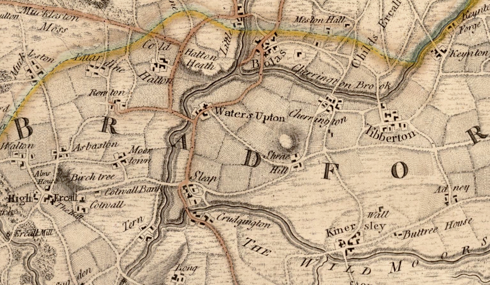
“To His Royal Highness George Prince of Wales &c. &c. This Actual Survey of the County of Salop” was “most humbly Inscribed” by John Rocque in (or by an Act of Parliament dated) 1752 (view original here). Although a more detailed map than those from the previous century shown above, this one was clearly not to scale, and illustrative rather than accurate – especially when it came to showing the road network. Other errors can be seen too, even in this small extract. The names of two neighbouring hamlets just South of Waters Upton – Crudgington and Sleap – have been mixed up, and Great Bolas is shown much closer to the confluence of the Tern and the Meese (or, as it is named here, Cherrington Brook) than was actually the case. Click / tap the image to view at full size. Added Nov 2025.
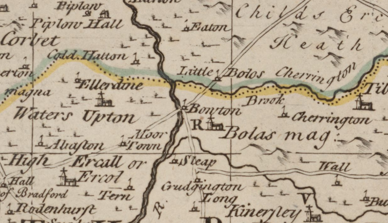
15 years later, an even more confusing map of Shropshire was produced. The copy held and digitised by the the National Library of Scotland (view original here) is damaged, so the title cannot be read in full, but ironically it began “An Accurate [Map of] Shropshire” and claimed to add “various additional Improve[ments]” to the maps, surveys and illustrations upon which it was based. Not only have the locations of Crudgington and Sleap been reversed yet again, but so too have those of Waters Upton and Rowton, each now shown on the wrong side of the River Tern. Little Bolas is shown roughly where Bolas Magna should have appeared, while the latter village is shown in entirely the wrong location. The illustration of a road running from Moortown directly to Rowton (i.e., Waters Upton) is misleading to say the least. I can only hope that this map was only ever used for decoration, and never for navigation! Click / tap the image to view this cartographic disaster at full size. Added Nov 2025.
1820s & ’30s
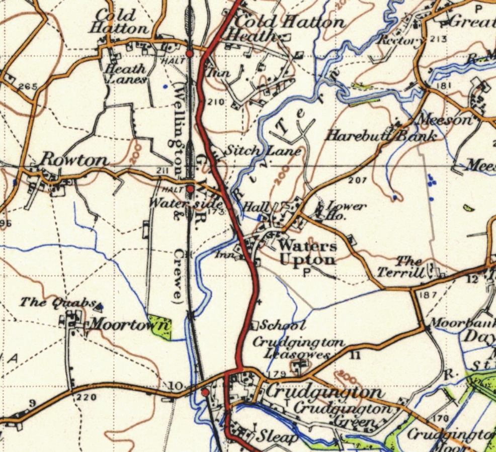
The “Map of the County of Salop” from which the extract below is taken (view original here), while not entirely accurate, was a huge improvement on those from the 1700s! It was made “from an Actual Survey Made in the Years 1826 & 1827, By C. & J. Greenwood” and was published on 2 July 1827 by Greenwood, Pringle & Co of London. The routes followed by the roads and watercourses on this map pretty much reflected reality, and the settlements too are for the most part correctly named and located. Curiously however, Cold Hatton is here named as Little Rowton. Another oddity is ‘Shray,’ a small group of houses on the lane running Southeast from waters Upton. This clearly a name taken from Shray Hill, situated to the East in neighbouring Bolas Magna parish, but I have seen no other examples of the name being used for this area of Waters Upton.
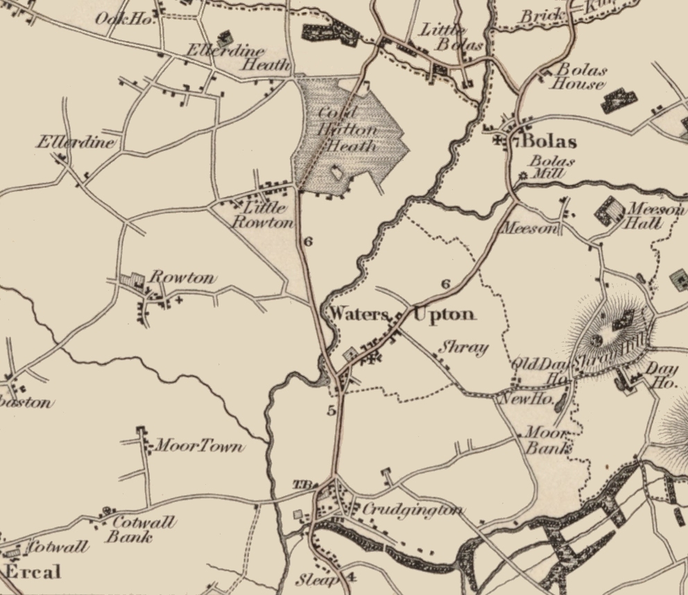
On the subject of parishes, the attempt made on this map to show parochial boundaries did not entirely succeed. In the case of Waters Upton, the boundary line is shown running South-eastward from the Tern at a point downstream from that river’s confluence with the Meese. In reality, the boundary between Waters Upton and Bolas continued along the Meese until that river’s North-eastward turn toward Bolas Mill. At that point the line left the river and cut across the road between Upton and Bolas villages, joining the boundary depicted here to the East of ‘Shray.’ Click / tap the image to view at full size. Added Nov 2025.
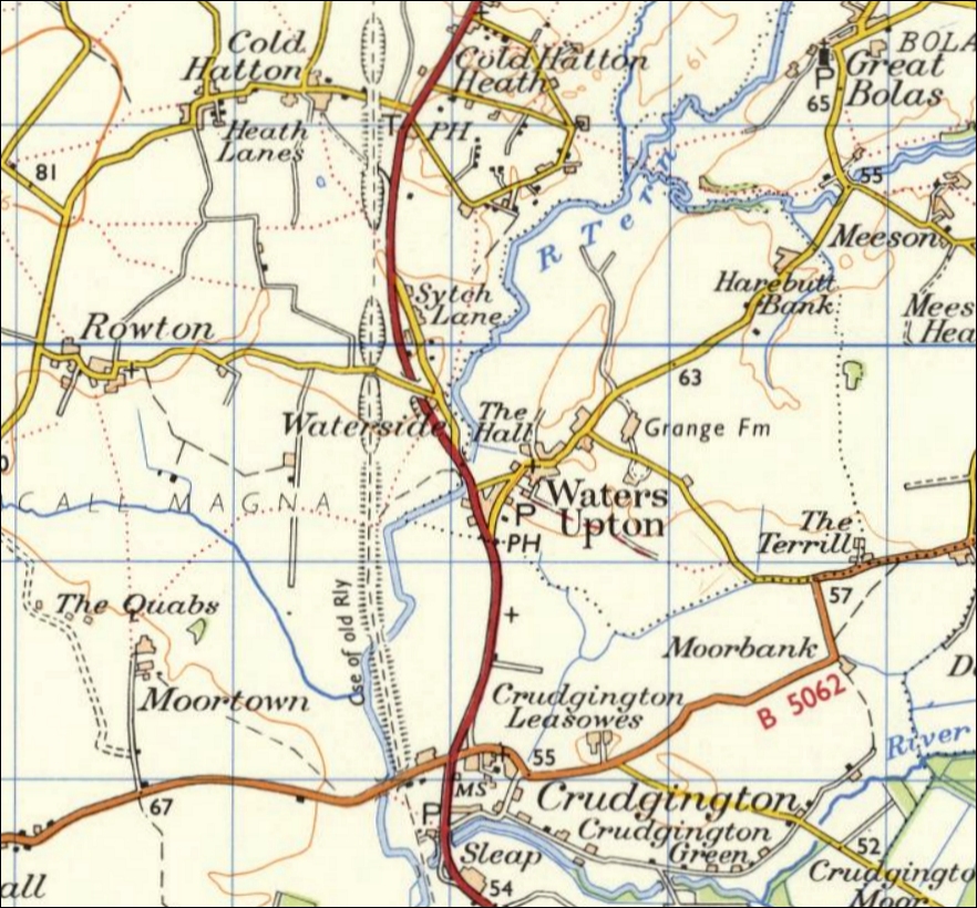
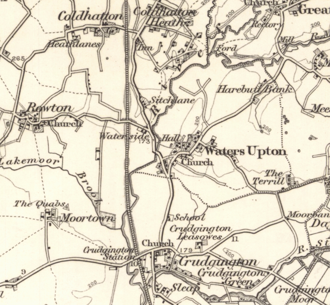
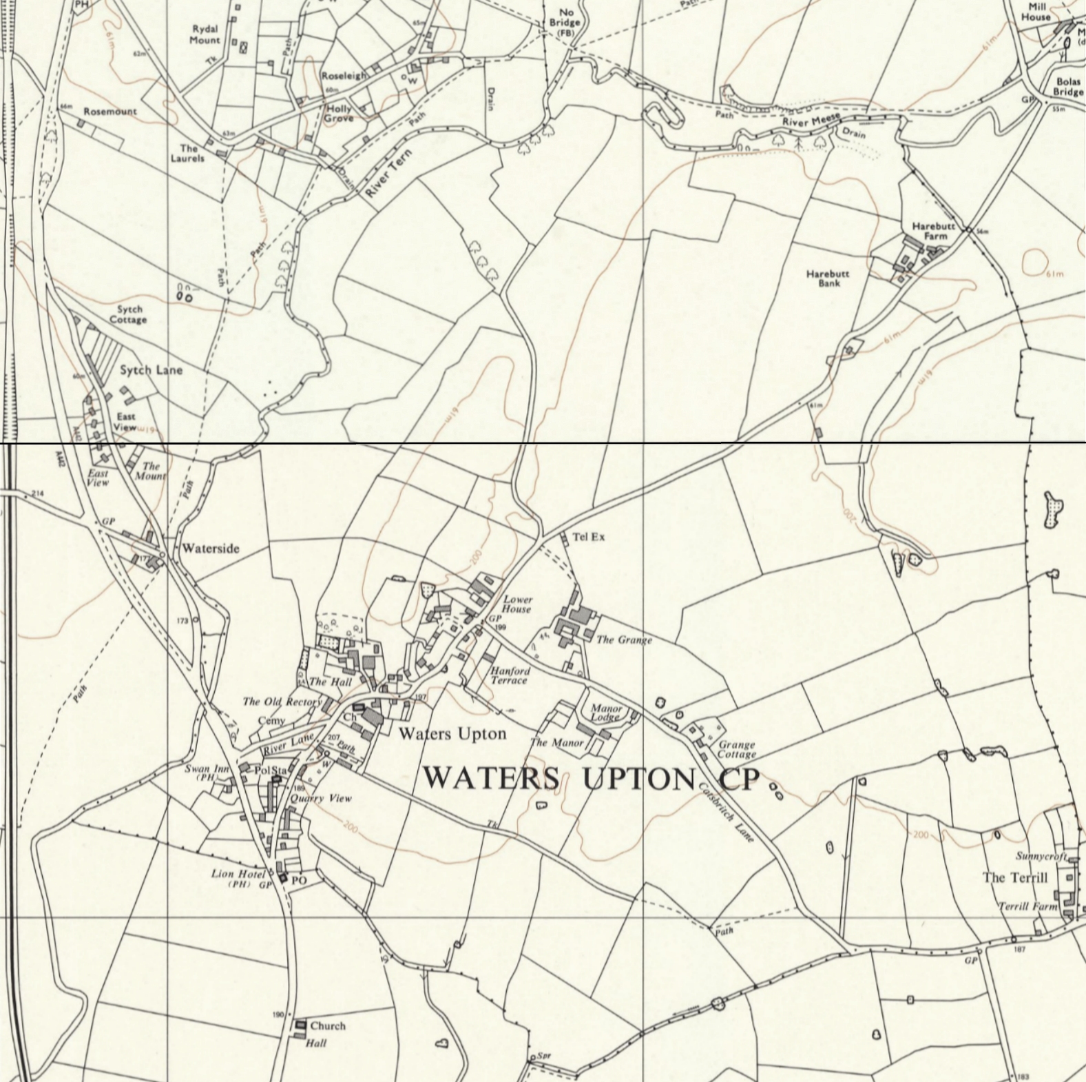
I made the map below by joining extracts from two early Ordnance Survey maps which, although printed in 1863, were based on surveys and revisions up to 1831. The Northern part is from 1-inch Sheet LXXIII SE (Market Drayton, view original here) was surveyed 1814 to 1831 and revised in 1831. The Southern part (1-inch Sheet LXI NE (Shrewsbury, view original here) was surveyed from 1814 to 1816 and revised from 1830 to 1831 (with railways, none of which lay within the extract I have used, revised 1859 to 1862). Parish boundaries were only shown on the Northern map. Click / tap the image to view at full size.

Details of roads, tracks, watercourses, woodlands and buildings can be seen, and all the settlements are named: Cold Hatton and Cold Hatton Heath to the north, Rowton to the west, Moortown to the south-west and Crudgington, with Crudgington Green, to the south all lie within the extensive parish of High Ercall or Ercall Magna. Great Bolas and Meeson are situated in the parish of Great Bolas or Bolas Magna. Notice Waters Upton Moor down in the Southeast corner of the map: part of the Wild Moors or Weald Moors, this was an outlying or detached part of Waters Upton parish at this time.
Within the parish of Waters Upton proper, Harebutt Bank (on the road to Great Bolas and Meeson) is not named and there are no buildings shown there. The Lion Inn is also not shown. Two dwellings recorded on the tithe map and apportionment schedule in 1837 on Catsbritch Lane (to the East of the village), which would later be demolished, are present: one is just above the ‘s’ of ‘Waters’ while the other is near the source of the stream that runs down to Crudgington. The Terrill is not named either (the name Day House refers to a dwelling just off this map extract), but the farm is shown plus, possibly, one other building immediately North of it.
1880s
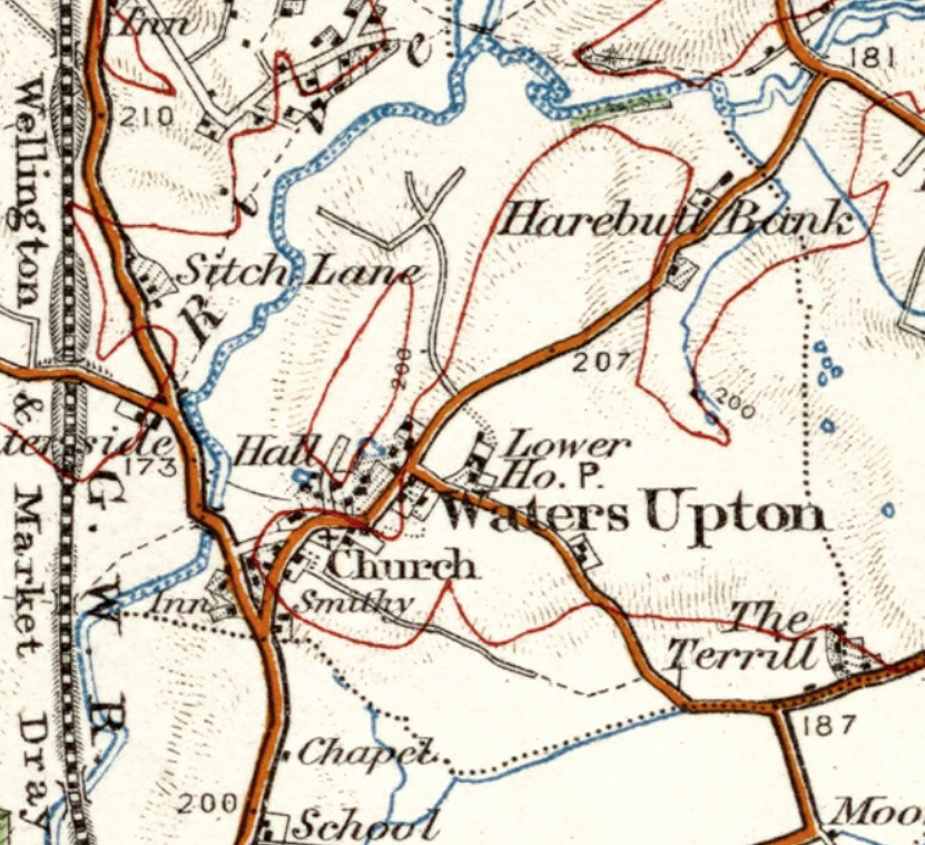
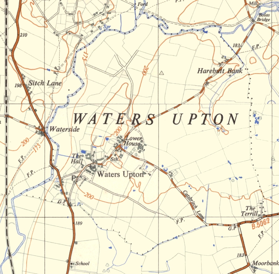
This is an extract from Ordnance Survey one inch to the mile map 138 (Wem, view original here), published in 1889. Parish boundaries are shown. Harebutt Bank is now named and all of its buildings are shown; the same applies to The Terrill. The Grange (or Grange Farm) also appears on the map, just above the ‘W’ of ‘Waters’. The school on the road to Crudgington is also present. The biggest change of course is the railway, running North-South just to the West of Waters Upton, and the station at Crudgington.
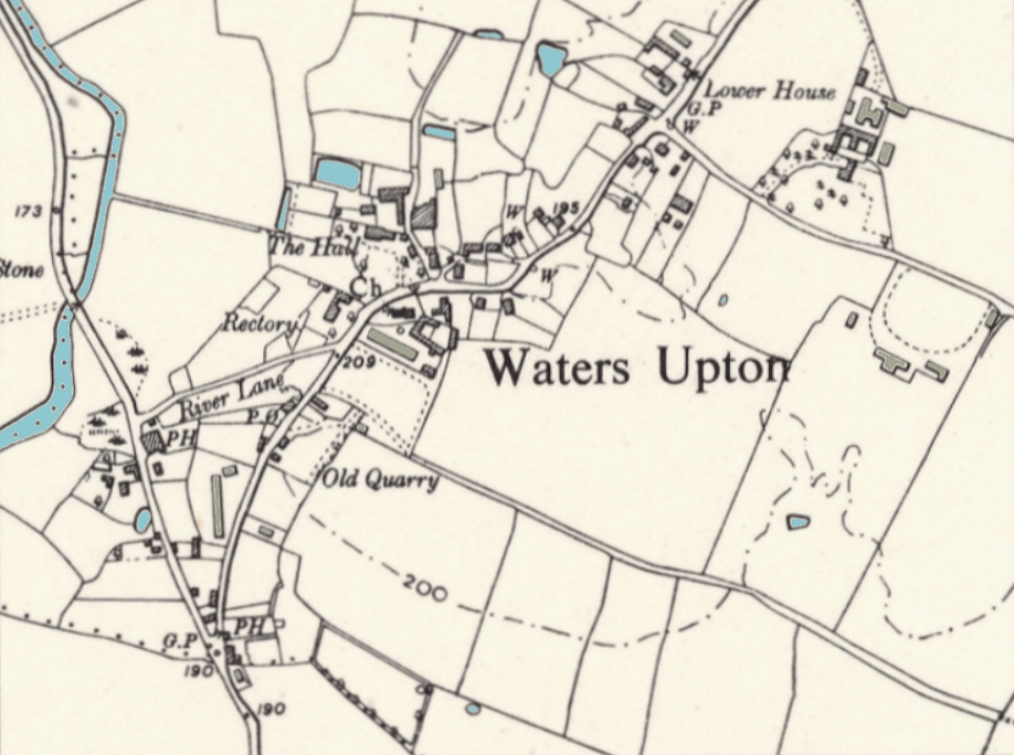
Let’s take a closer look at the village and the houses elsewhere in Waters Upton parish in this decade, as shown on six inch to the mile Ordnance Survey mapping published in 1886/1887 (and based on surveying carried out in 1880).
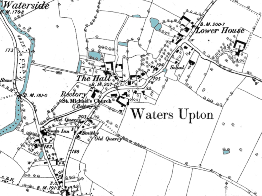
In the map extract above (view original here) we can see individual buildings, with several named in addition to the church and The Hall: the Swan Inn, the Smithy, the Rectory, the school, and Lower House (a farm, to the left of the word ‘Lower’). Not named, but of note as structures which (like the school) appeared after the 1830s, are the aforementioned Grange Farm, and, a little to the East of the school, the block of four houses later named Hanford Terrace.
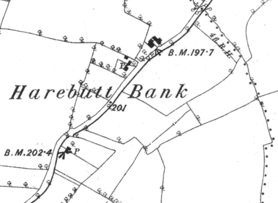
The above extract (view original here) shows, from top to bottom, Harebutt Farm, The Harebutts, and two semi-detached cottages (later numbered 39 and 40 Waters Upton).
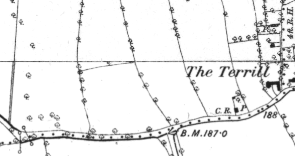
The extracts above (view original here) and below (created from the previous original plus this map) show parts of Catsbritch Lane and, at its far end (below) The Terrill. Above, from top to bottom (or left to right) are the dwellings later named Melverley House, Linden Lea and Grange Cottage. Below, from top to bottom, are those which were later named / numbered Sunnycroft, Saxon Park House, The Terrill Farm (number 45), and number 44 Waters Upton.
1900s
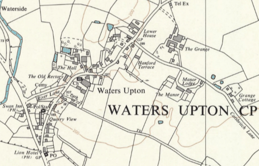
Back to one inch to the mile scale mapping now (in colour!), and zooming in from looking at Waters Upton and surrounding area to a view of the parish. This extract from 1-inch Sheet 61 (Shrewsbury, original here) was published in 1908 and included revisions from 1904 to 1905. Little change is apparent within the parish, apart that is from Grange Farm being named Lower House in error! A new feature just South of the parish is the chapel built near the school.
1910s
Although published in 1921, the one inch to the mile map from which this extract is taken (original here) was based on earlier surveys and revision up to 1916-17. No other changes of any substance are shown – therein lies the oddity of this map. Waters Upton Manor, built on the South side of Catsbritch Lane before the Valuation Office survey of 1910-15 was carried out, is not shown. It should be visible above the ‘r’ and ‘s’ of ‘Waters’. This, and the ongoing error of attributing the name Lower House to Grange Farm, continued in later maps until the 1940s.
1930s
From 1931 to 1938, the First Land Utilisation Survey maps of Britain were published, using Ordnance Survey 1-inch mapping as their base. Sheet 61 (Wolverhampton, original here) was surveyed between 1932 and 1935 and published in 1938. The extract here shows Waters Upton parish (though the parish boundaries are not indicated). Notice that the railway line, previously designated ‘Wellington & Market Drayton,’ is now ‘Wellington & Crewe,’ and that a halt is shown just south of the bridge carrying the Waterside to Rowton road over the railway. In addition, the course of the road over the bridge at Waters Upton is now different.
(Compare the above with the Second Land Utilisation Survey mapping below.)
1940s
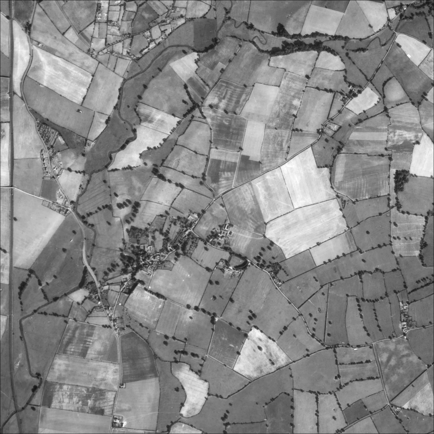
OK, this is clearly not a map! But when I discovered that the US National Archives website had aerial photos from the 1940s featuring Waters Upton, with no restrictions on their use, I could not resist including an extract from one of them here (I have rotated and cropped the original image so that the extract more or less matches the area covered by my map extracts showing the parish, and enhanced it). What makes the photos even more interesting is that they are from a collection of “German Flown Aerial Photographs” taken during the Second World War. This image is much larger than can be displayed within the constraints of this page; a click / tap will show it at its full size.
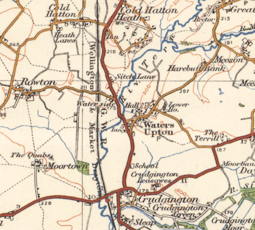
The map extract below is from 1-inch Sheet 119 (Stafford, view original here). The map was revised in full 1920, with later corrections, and published in 1946. The various changes noticed in the Land Utilisation Survey map above can also be seen here, along with parish boundaries and 1 kilometre grid lines. We can also see that in addition to the halt on the railway at Waterside, there was also one at Cold Hatton.
1950s
The map below is derived from two 1:25,000 scale Ordnance Survey sheets from around 1949-50 (view original sheets for the Northern and Southern parts). Waters Upton Manor is now shown (by the ‘n’ of ‘Upton’), though not named. There are also some buildings, most likely barns, sheds or other agricultural buildings, not shown on previous mapping, to the South-west of the church (roughly where The Stackyard is now situated). This larger scale map provided space to display the name Lower House to the left of The Grange, so that it was next to the property it actually related to.
Next we zoom in on two maps, both from later in the 1950s and both showing changes, but with different levels of detail due to their different scales. The first is a 1:10,560 or 6 inches to the mile map (SJ61NW, view original here); also viewable as part of a composite ‘seamless’ map), published in 1954 with pre-1930 revisions plus major changes from 1949, to which I have added shading for the water features, and for buildings not shaded on the original map. The second is, like those from which the map above is created, a 1:25,000 scale map (SJ61, view original here), published in 1957 and based on mapping last fully revised 1900-25 with revisions from 1938-49 incorporated.
Now, in addition to the Manor, Manor Lodge can be seen, situated on Catsbritch Lane at the Easternmost entrance to the Manor. Quarry View, with its four pairs of semi-detached houses (three of those pairs shown as a single long building), lies in what I call ‘the River Lane triangle.’ And there is a new building just outside the Waters Upton parish boundary, immediately South of the Lion Inn. Although not shown on earlier maps, this building is depicted – as a garage and Post Office – on a postcard franked in 1936!
1960s
The areas covered by Ordnance Survey 1-inch maps sometimes overlapped. Such was the case with Sheets 118 (Shrewsbury) and 119 (Stafford), both of which included Waters Upton. Here’s an extract from a copy of Sheet 118 (view original here) published in 1961 and reprinted in 1965, incorporating revisions from 1959 to 1965. A new stretch of road bypassing Waterside and Sytch Lane is now shown, and at long last, Grange Farm is named correctly!
This extract from Sheet 119 (view original here), published in 1963 and reprinted in 1969 with revisions from 1959 to 1968, features a crop that is slightly different to the one I use for my usual ‘Waters Upton and neighbourhood’ view. That’s so that I can include a feature not far from Waters Upton, which had been present since the Second World War and was included on the 1:10,560 map published in 1954 (though not on the 1:25,000 maps of the ’50s). Only now did the airfield on the West side of Moortown appear on 1-inch mapping, by which time it was disused.
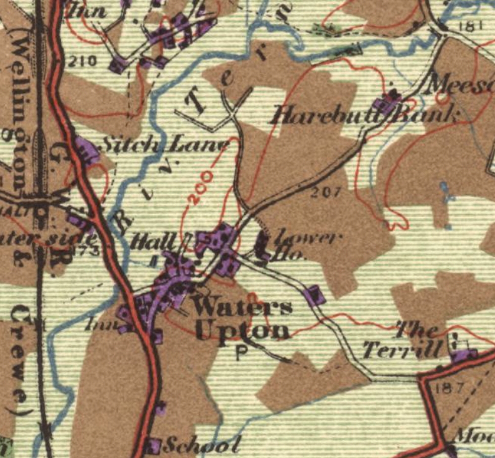
The Second Land Utilisation Survey of Great Britain (the first was in the 1930s) took place from around 1958 to 1974. I am not sure when the two maps covering Waters Upton parish were completed, but the 1960s seems the best decade to place the map below that is based on them (view original here).
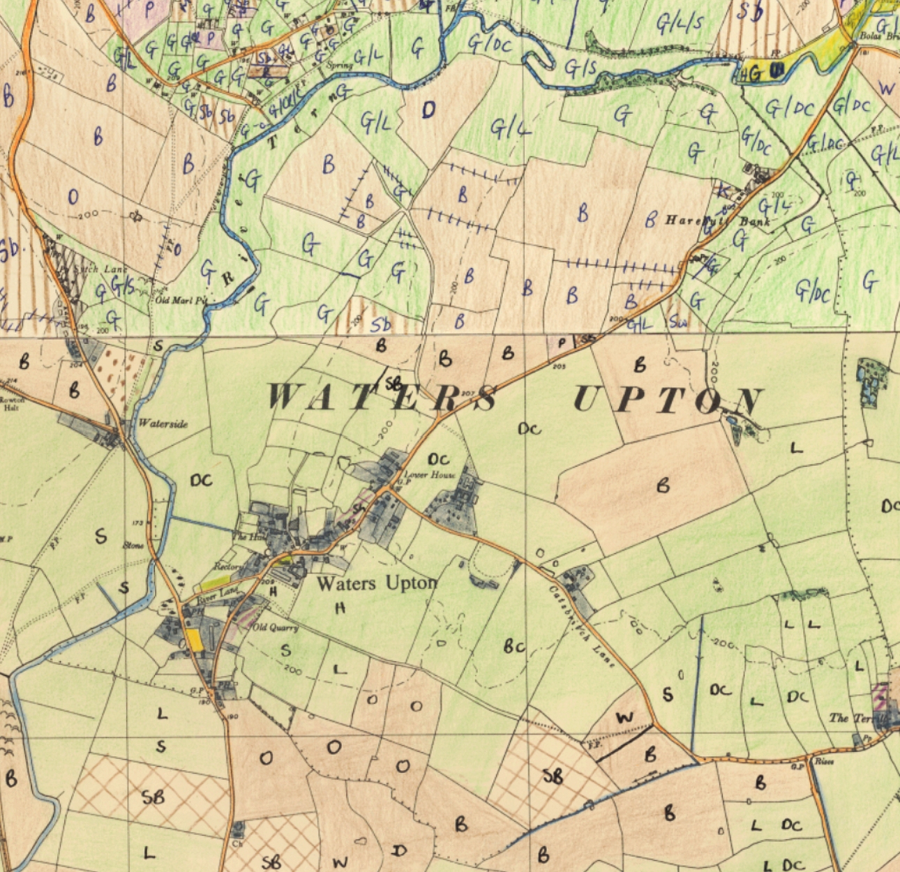
It appears that the two maps in question were completed at different times, and possibly by different people. There are certainly inconsistencies in the way in which the Northern and Southern parts of the combined map above were created, and not just the in colour of the ink used for annotations. Click / tap the image to view at full size.
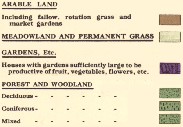
The colours used to indicate the land use category of each field or parcel of land were largely the same as those used for the first survey: brown for arable land, pale green for grassland, and dark green for woodland. However greyish rather than purple was used for built-up areas, a bright yellow-green for open space (the churchyard and cemetery in the case of Waters Upton), yellow for heath and rough land, purple for market gardening, and purple stripes (on a pale green background if with grass) for orchards. In addition, there were codes to represent crops and livestock (provided in a surveyors’ field check list). Those used on the maps covering Waters Upton were as follows:
Grassland – G (with an L to be added ‘if an undoubted ley’). Animals – Horses, Sheep, Calves or Cattle not identified, Beef Cattle, Dairy Cattle.
Arable land, Crops – (Cereals) Wheat, Barley, Oats, (Roots) Swedes, (Green Fodder) Kale [a single, small field at Harebutt Bank is annotated K], (Industrial Crops) Sugar Beet.
Market Gardening, Crops – Potatoes.
The above map is based on an image on the National Library of Scotland Maps website, created from maps provided by the Trustees of the Land Use Research Unit established by Professor Alice Coleman, and is used here under a Creative Commons (CC BY-SA-NC) Licence. Added Nov 2025.
1970s
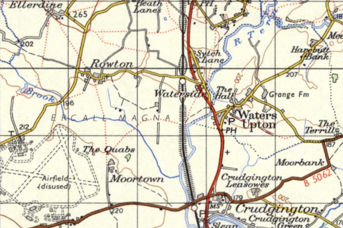
The most recent Ordnance Survey maps that I can feature on this website are those from the first half of the 1970s (specifically, as of 2025, those published in or before 1974 – later maps are still in copyright). They include some marvellous, modern-looking mapping at the 1:10,560 scale, showing the beginnings of a surge of house-building in Waters Upton village. Here’s an extract from Sheet Sheet SJ61NW (view original here), surveyed / revised from 1967 to 1970 and published in 1970 (to which I have added colouring for the water features). Worth a click to view at a larger size.
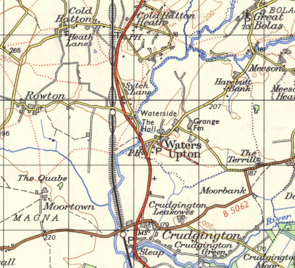
For a view of the whole of Waters Upton parish using this mapping, I have added to an extract from SJ61NW, one from SJ62SW to the North (view original here), surveyed / revised from 1970 to 1972 and published in 1972. Notice that the railway line is shown as being in use on the Southern part, but disused in the Northern part. Click / tap the image to view at full size.
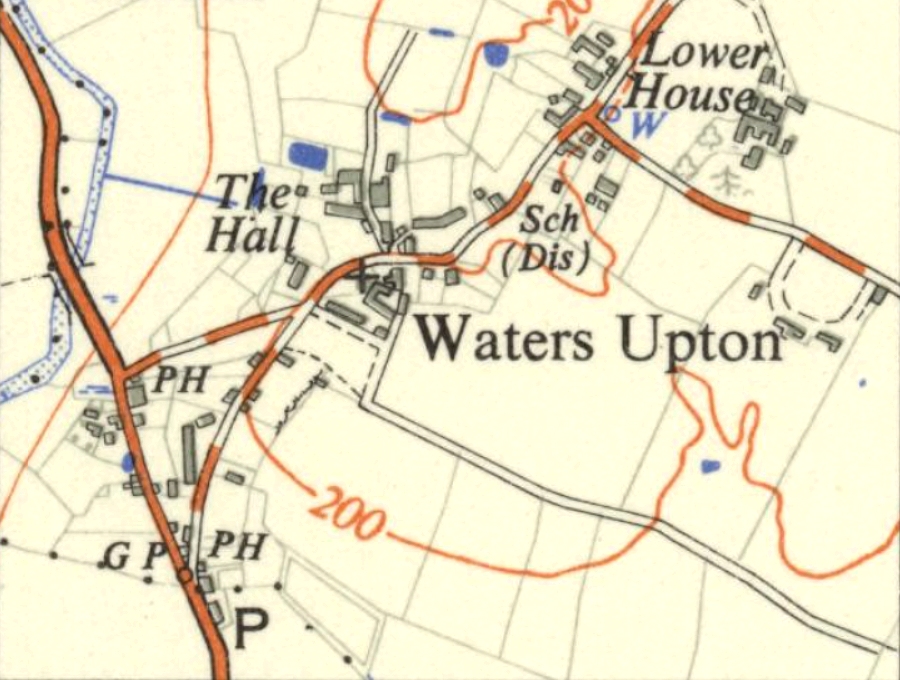
Finally, back to smaller scale mapping (now 1:50,000 rather than 1-inch to the mile) and a view of Waters Upton and its immediate neighbourhood. This is an extract from Sheet 127 (Stafford and Telford, view original here), incorporating revisions from 1959 to 1973 and published in 1974. Waters Upton’s new housing is not shown here, but the demise of the nearby railway line has been captured.